El Niño is again becoming one of the world’s most important weather stories, with the World Meteorological Organization warning that the Pacific climate pattern is highly likely to return in 2026 and shape global conditions into 2027.
The WMO said there is an 80% chance of El Niño forming before September and a 90% chance of it continuing into November. Most forecast models point to at least a moderate event, though some projections suggest it could strengthen if warm water continues building across the central and eastern tropical Pacific.
For readers, the concern is simple: El Niño can temporarily raise global temperatures, shift rainfall patterns and alter storm seasons. It is a natural climate cycle, but it is now developing in a world already made warmer by long-term climate change. That makes the possible 2027 impact more serious than a normal seasonal forecast.
The WMO’s latest update, available through its official El Niño outlook, says warmer-than-average subsurface waters in the equatorial Pacific are supporting the expected transition. Scientists are also watching a downwelling Kelvin wave, a pulse of warm water moving eastward beneath the ocean surface, which can help lift sea temperatures toward El Niño levels.
Why El Niño Matters for 2027
The last major El Niño in 2023-24 helped push global temperatures to record levels. Another strong event could raise the odds that 2027 becomes one of the hottest years ever recorded, especially if ocean heat continues feeding into the atmosphere.
Weather impacts will not be the same everywhere. In the United States, El Niño often strengthens the southern storm track, increasing rain chances across the southern states, Gulf Coast and Florida. That can bring flood risk, but also temporary drought relief in some areas. The northern U.S. and Pacific Northwest often lean warmer and drier.
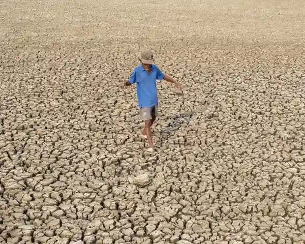
Globally, heavier rainfall is often seen in parts of South America, the Horn of Africa and Central Asia. Drier conditions can hit Australia, Indonesia, Central America, the Caribbean, northern South America and parts of South Asia. These regional shifts matter because they can affect crops, water supplies, shipping routes and food prices.
Hurricane seasons may also split in opposite directions. El Niño usually supports more activity in the eastern and central Pacific by creating warmer, more favorable waters. In the Atlantic, it often increases vertical wind shear, which can weaken or disrupt developing storms. That does not remove landfall risk, but it can reduce overall storm formation.
Food security is another major concern. Climate stress has already affected harvests in several regions, and El Niño can add drought or flood pressure at the wrong point in the growing season. For households, that can show up later as higher prices for staples, especially if multiple crop-producing regions are hit at the same time.
Read More
Swikblog has also covered how changing climate risks can affect countries and economies in its report on countries most exposed to climate, war and economic pressure by 2050.
The WMO has avoided calling this a “super El Niño,” because that phrase is not part of its official classification system. Still, the warning is significant. A high-probability El Niño arriving after years of extreme heat gives governments, farmers, insurers and emergency planners a narrow window to prepare before the weather signal becomes stronger in 2027.
Make Swikblog your go-to source on Google for reliable updates, smart insights, and daily trends.