
Three shallow earthquakes struck near Piopiotahi/Milford Sound on Wednesday evening, September 2, 2026, rattling communities across the lower South Island and forcing the overnight closure of the historic Edith Cavell Bridge near Queenstown. The strongest measured magnitude 5.6 and followed an initial magnitude 5.5 quake less than an hour earlier.
The sequence was widely felt across Otago and Southland, with thousands of people reporting shaking. Residents described sharp jolts, rolling movement, loud rumbling and rattling windows, while authorities shifted their attention to infrastructure checks, possible rockfall and further seismic activity.
Milford Sound earthquake timeline
South New Zealand , far Southern tip of the Southern Alps, has just been hit by a noteworthy M5.3 to M5.5 earthquake, the first of this size for the location in many months !https://t.co/FCTZwI9m5R pic.twitter.com/VlAahDFVV4
— Dutchsinse (@RealDutchsinse) September 2, 2026
The first major quake struck at 6.13pm, about 40km northeast of Milford Sound. It measured magnitude 5.5 and occurred at a shallow depth of about 5km.
A second, slightly stronger magnitude 5.6 earthquake followed at 6.57pm, around 35km northeast of Milford Sound and also about 5km deep.
Then, at 7.12pm, a magnitude 4.6 quake struck in the same general area. The first two earthquakes were reported as producing moderate shaking, while the third produced lighter shaking.
People can follow revised magnitudes, locations and subsequent activity through GeoNet’s official earthquake monitoring service. GeoNet had also recorded a smaller magnitude 2.2 quake about 45km northeast of Milford Sound at 4.59am on Wednesday, at a depth of 5km.
Thousands feel shaking across the South Island
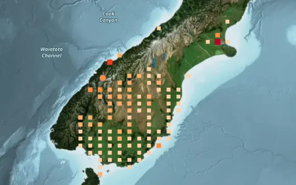
About 6,000 people reported feeling the first earthquake within roughly 10 minutes, according to reports from the event.
Shaking was reported in Queenstown, Arrowtown, Alexandra, Invercargill and Caversham, among other communities.
In Queenstown, shaking was described as lasting roughly 15 to 20 seconds. Other accounts included sudden jolts, loud booming or rumbling noises and windows rattling. One Arrowtown resident reported that an object fell from a pantry during the shaking.
The shallow depth helps explain why the earthquakes felt pronounced in parts of the region. Shallow earthquakes release energy closer to the surface, although the shaking experienced in individual towns also depends on distance, geology and building construction.
New Zealand experienced another widely felt event earlier this year when a magnitude 5.4 earthquake struck the central North Island, although that earthquake occurred at a much greater depth.
Edith Cavell Bridge closed overnight
The most significant confirmed disruption so far is the precautionary closure of the Edith Cavell Bridge over the Shotover River near Arthur’s Point.
Queenstown Lakes District Council said the heritage bridge would remain closed overnight and engineers would inspect it at first light before deciding whether it could reopen.
Traffic from Arthur’s Point was being directed via Malaghans Road in Dalefield.
Motorists were also urged to take care around alpine routes including Crown Range Road, where earthquake shaking could dislodge rocks or other debris.
The bridge closure does not itself confirm structural damage. Inspections can be required after significant earthquakes as a safety precaution, particularly for historic infrastructure.
Are there injuries or earthquake damage?
There were no immediate reports in the available information of serious injuries or widespread structural damage.
Authorities will be watching roads, bridges and other infrastructure as assessments continue. Natural hazards can quickly disrupt essential services across the region, as seen when severe weather and a grid fault disrupted power across Southland and Otago earlier this year.
Is there a tsunami warning for Milford Sound?
The available information does not indicate that Wednesday evening’s earthquakes generated a tsunami.
That is important because Milford Sound has a separate, well-recognised natural-hazard risk involving earthquake-triggered landslides. Emergency planning has examined scenarios in which large sections of the steep surrounding terrain could collapse into the fiord and potentially generate dangerous local waves.
Those long-term risk assessments should not be confused with what happened on September 2. There is no indication in the information available that the latest earthquake sequence triggered such an event.
Egypt Bus Crash Today: 16 Killed, 28 Injured in South Sinai
Matt Dee Bondi Rescue Cause of Death: Tributes and What We Know
Why Milford Sound’s location matters
Fiordland is one of New Zealand’s seismically active regions and sits close to the wider Alpine Fault system.
Emergency planners have examined how a major Alpine Fault earthquake could cause landslides, damage roads and bridges and isolate South Island communities. That broader risk does not mean Wednesday’s earthquakes are evidence that a major Alpine Fault rupture is imminent.
Public safety advice after the earthquakes
People in areas affected by the shaking should be prepared for further earthquakes and follow instructions from GeoNet, local councils and New Zealand Civil Defence. Aftershocks can occur without warning and may create additional rockfall or affect structures already weakened by earlier shaking.
If another earthquake begins, the standard safety advice is to Drop, Cover and Hold. Drop to your hands and knees, take cover under a sturdy table or other suitable shelter, protect your head and neck, and hold on until the shaking stops.
After strong shaking, stay away from visibly damaged buildings, fallen power lines, unstable slopes and locations where rocks or debris have fallen. Drivers around Fiordland and Queenstown should take particular care on steep alpine roads and obey all closures, barriers and official detours.
People near the coast should also remember New Zealand’s “Long or Strong, Get Gone” tsunami advice. If earthquake shaking lasts longer than a minute or is strong enough to make standing difficult, move immediately to the nearest high ground or as far inland as possible rather than waiting for an official warning.
Visitors unfamiliar with the area should identify local evacuation routes and follow emergency signage. Official GeoNet, Civil Defence and council updates are preferable to unverified social-media posts during a developing event.
What residents and travellers should watch now
Further earthquakes may follow the sequence, although their timing and magnitude cannot be reliably predicted.
People around Milford Sound, Queenstown, Te Anau and surrounding areas should continue following GeoNet and local civil defence updates, respect road or bridge closures and remain alert for debris on steep alpine routes.
The next major practical development will be the engineering inspection of Edith Cavell Bridge, along with any further significant earthquakes, confirmed damage or updated emergency advice.

Make Swikblog your go-to source on Google for reliable updates, smart insights, and daily trends.