A major flood watch has been issued across most of Queensland as Tropical Low 29U approaches the coast, bringing the threat of widespread heavy rain, rapidly rising rivers and possible transport disruption across large parts of the state.
The alert, issued by Australia’s Bureau of Meteorology on Friday afternoon, warns that widespread minor to moderate flooding is possible, with isolated areas at risk of major flooding if intense rainfall develops over the coming days.
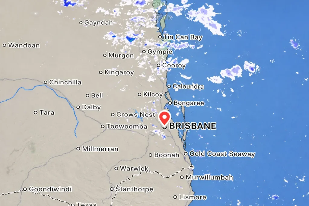
The developing weather system is expected to move across northern Queensland before spreading heavy rainfall southward, potentially affecting major population centres including Brisbane and surrounding Southeast Queensland communities over the weekend.
Tropical Low 29U approaching Queensland coast
According to meteorologists, Tropical Low 29U is forecast to cross the Queensland coast near Innisfail, triggering heavy rainfall across the North Tropical Coast and nearby inland regions.
As the system weakens and moves further inland, the rainfall zone is expected to expand across central Queensland before shifting into the southeast part of the state. This pattern raises the risk of significant rainfall totals across river catchments that are already wet from recent weather systems.
Weather models indicate that rainfall could intensify across parts of the northern interior and Townsville coast first, before moving toward Capricornia, the Wide Bay region and eventually Southeast Queensland.
Authorities warn the exact timing and location of the heaviest rainfall remains uncertain, meaning some communities may experience flooding earlier than expected.
Brisbane forecast: humid weather and showers
Current conditions in Brisbane show cloudy skies and humid weather, with temperatures sitting near 24°C early Saturday morning and a RealFeel temperature close to 29°C.
The forecast for the day includes considerable cloudiness with scattered showers, with rainfall totals between 0 and 20 millimetres possible. Afternoon temperatures are expected to climb toward 31°C before easing overnight.
Forecasters also warn that heavier showers could develop later tonight as moisture from the tropical system moves further south.
Wind conditions remain relatively light across the Brisbane region, with southeasterly winds around 4 kilometres per hour and gusts reaching approximately 11 kilometres per hour.
Multiple river catchments under flood watch
The flood watch spans dozens of river systems across Queensland, highlighting the broad geographic impact the rainfall system could produce.
Key river catchments under monitoring include the Brisbane River, Logan River, Albert River, Mary River and Noosa River, along with numerous waterways across the Sunshine Coast and surrounding regions.
Authorities have also issued flood alerts covering the Upper Brisbane River, Lower Brisbane River, and the Logan and Albert river systems, which could experience rapid rises if rainfall intensifies.
Elsewhere across Queensland, major catchments including the Fitzroy River system, Burdekin River, Pioneer River and Burnett River are also being closely monitored due to the potential for heavy rainfall across central parts of the state.
Existing flood warnings already active
Several flood warnings are already active in northern Queensland following earlier rainfall events during February.
Catchments currently under flood warning include the Daintree, Mossman, Bloomfield and Norman rivers. In western Queensland, moderate flooding has also been recorded along parts of Magnificent Creek near Kowanyama.
Emergency authorities say these already saturated catchments may respond quickly if additional rainfall develops.
Transport disruption possible across parts of Queensland
Emergency agencies warn that flooding could disrupt road networks, particularly in rural areas where waterways can rise rapidly during heavy rainfall.
Rapid river level rises, flash flooding and flooded low-lying roads remain the primary concerns for communities across central and southeastern Queensland.
Officials say travel conditions may deteriorate quickly during heavy rain, particularly across highways connecting regional towns.
Authorities urge residents to stay alert
Emergency management officials are urging residents across Queensland to stay informed as the weather situation develops over the coming days.
Authorities warn residents not to drive or walk through floodwaters, noting that even shallow water can hide strong currents or damaged roads.
Residents are also advised to stay away from flooded creeks, rivers and drainage channels and to follow all road closure signs issued by emergency services.
The situation is expected to evolve rapidly through the weekend, with forecasters continuing to monitor the movement of Tropical Low 29U and its rainfall impacts across Queensland.
Latest forecasts and warning updates are available from the Bureau of Meteorology weather warning service.
Make Swikblog your go-to source on Google for reliable updates, smart insights, and daily trends.