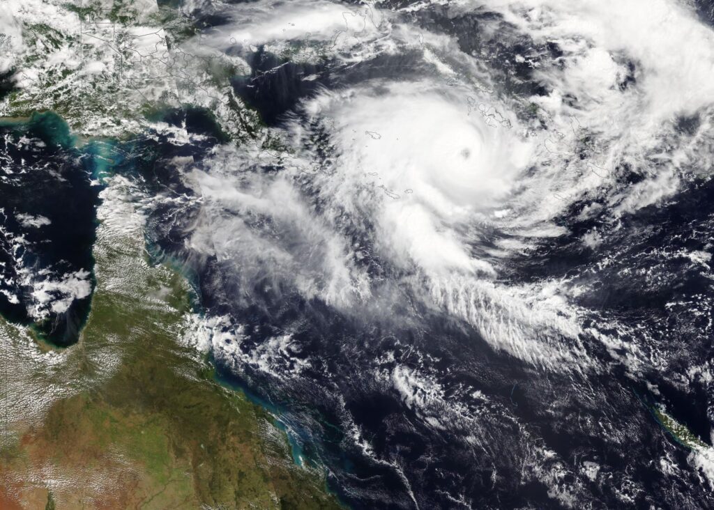
Severe Tropical Cyclone Maila has surged into a Category 5 storm over the Solomon Sea, putting far north Queensland back in the spotlight just weeks after Cyclone Narelle battered the same broad region. The system has quickly become one of the most powerful storms of the Australian cyclone season, and while forecasters expect some weakening before landfall, the threat is still serious enough to put communities across Cape York and nearby coastal areas on high alert.
For many readers searching for the latest Cyclone Maila update, the biggest concern is no longer whether the system is dangerous. It clearly is. The real focus now is on where it crosses, when conditions begin to deteriorate, and how much rain Queensland could absorb after an already punishing run of wet weather. That combination is what is making this system especially worrying.
Cyclone Maila path puts Cape York and far north Queensland in focus
Maila was located over the Solomon Sea as it intensified, with the storm expected to track south-west toward the Queensland coast. Current projections place the most likely landfall window early next week, with late Monday seen as one of the key points being watched. Forecasters have indicated that the most closely monitored stretch of coastline runs broadly between Lockhart River and Cairns, although any shift in track over coming days could still move that risk zone north or south.
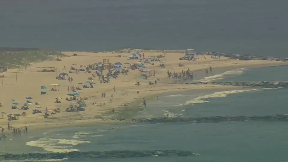
That uncertainty matters because tropical cyclones do not need a perfect direct hit to cause major disruption. Even if the centre crosses away from a major town, outer rain bands can still deliver flooding rain, dangerous surf, damaging winds and transport disruption well outside the core impact zone. That is why communities across far north Queensland are already being urged to prepare before the weekend.
Maila’s intensity has grabbed attention for another reason too. The storm’s minimum central pressure has been reported at 924 hPa, lower than Cyclone Narelle’s 930 hPa, a sign of a more intense system at peak strength. In practical terms, that means the cyclone has developed into a storm with enough structure and power to rank among the strongest of the season, even if it weakens somewhat before crossing the coast.
Heavy rain and flood risk may become the bigger Queensland story
For residents and searchers looking up “Cyclone Maila flood risk” or “Queensland weather warning,” the rainfall side of this event may be just as important as the wind category. Officials have warned that impacts could start to build from the weekend onward, with the greatest concern centred on heavy rain, flash flooding, river rises, strong winds and hazardous surf. In already saturated catchments, fresh downpours can trigger fast-moving problems even before the cyclone itself arrives.
This is the detail that gives Maila extra significance. Northern Queensland has not had much time to recover from earlier severe weather, and soils and waterways in some areas remain under pressure. A slow-moving or moisture-heavy system can stretch emergency resources, delay travel, isolate communities and create flooding issues that linger after the headline wind threat starts to fade.
Another complication is Maila’s projected movement near the southernmost islands of Papua New Guinea. Interaction with nearby land can affect both structure and speed, which means forecasters are still watching for changes in strength and timing. That uncertainty is a reminder that people in the potential impact zone should follow the latest official track advice instead of locking onto a single model snapshot too early.
For the latest official forecast track, warning zones and cyclone advice, readers can check the Bureau of Meteorology tropical cyclone track map.
Maila is also arriving in a season that has already been unusually active. The storm is the seventh system this season to reach severe tropical cyclone strength, meaning Category 3 or higher. That statistic alone shows how intense this weather period has been across the region. It also helps explain why public attention has sharpened so quickly around this system, especially in Queensland, where storm fatigue is becoming part of the story.
The comparison with Cyclone Narelle is unavoidable. Narelle made landfall on 20 March as a Category 4 system and went on to become a rare long-tracking storm that affected multiple parts of Australia. It brought heavy rain to Cape York and renewed flooding further inland, leaving behind a fresh memory of how disruptive a severe tropical system can be even after the strongest winds begin to ease. Maila is now following a similar broad corridor toward the northeast coast, which is why local nerves are already rising.
There are also early signs of Maila’s destructive power outside Australia. Reports and images from the Solomon Islands have shown damage to property in remote areas, offering a stark preview of what a storm of this scale can do before it ever reaches the Queensland coast. That regional impact adds to the seriousness of the latest warnings and shows that Maila is not simply a forecast threat on a map.
Queensland may not end up taking the cyclone at its strongest, but it could still face a dangerous mix of flood-producing rain, coastal hazards and strong winds across a vulnerable stretch of coastline. For communities between Cape York and the far north coast, the next few days will matter enormously, and every forecast update will be watched closely.
Author Bio
Chetan is a Swikblog writer with 5 years of experience covering global news, stock market developments, and trending topics, focusing on clear reporting and real-world context for fast-moving stories.
Make Swikblog your go-to source on Google for reliable updates, smart insights, and daily trends.