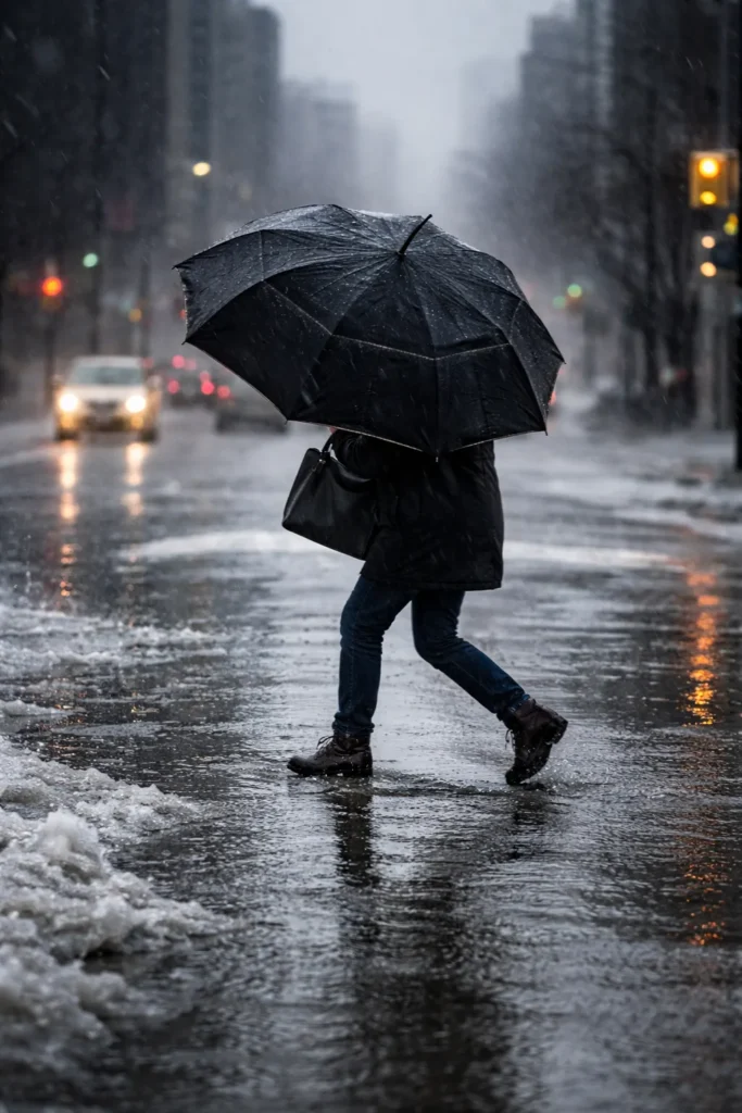
Yellow weather warnings for freezing rain are stretching across large parts of Canada this weekend, setting up a messy and potentially dangerous shift from deep winter to early spring. The latest advisory picture points to a country split between icy roads in the east, heavy rainfall on the West Coast, and blizzard conditions farther north, creating a weekend where travel plans could change quickly and local conditions may feel very different from one province to the next.
What makes this weather event stand out is not just the number of provinces under alert, but the range of hazards packed into a short period. In some regions the concern is a thin glaze of ice that can turn sidewalks, bridges and secondary roads treacherous in minutes. In others it is soaking rainfall, poor visibility or sudden swings in temperature. According to Environment Canada, the pattern now in place is bringing freezing drizzle, freezing rain, fog, heavy rain and blizzard risks into the same national weather story.
The key risk this weekend is not a single storm hitting the whole country in the same way. It is a patchwork of fast-changing local hazards, with freezing rain and reduced visibility posing the biggest concern for many communities under yellow warning zones.
Ontario faces icy pockets even as temperatures begin to climb
Ontario is one of the provinces drawing close attention as freezing drizzle and fog advisories raise the threat of slick surfaces, especially during the overnight and early morning hours. Patchy freezing rain can look minor on radar and still have an outsized impact on travel, because even a light coating of ice can make ramps, overpasses, parking lots and sidewalks unexpectedly dangerous.
At the same time, parts of southern Ontario are heading into a relatively mild weekend by early March standards. In the Greater Toronto Area, temperatures are expected to push toward 15 C on Saturday, with a chance of showers before sunnier conditions arrive Sunday. Ottawa is also set for a milder stretch, with a high near 11 C on Saturday and mixed conditions heading into Sunday. That combination of warmer air and lingering icy pockets is exactly what can catch drivers and pedestrians off guard.
Quebec and Atlantic Canada stay in the freezing rain zone
Quebec remains one of the clearest examples of why yellow warnings matter. Several regions, including Québec City, Charlevoix, Saguenay Lac Saint Jean and surrounding areas, are in line for freezing rain beginning Friday night and lasting into Saturday morning. Even where ice accumulation stays relatively light, the danger rises quickly when temperatures hover near the freezing mark and roads appear wet rather than visibly frozen.
Montreal is expected to see a milder but wet weekend, with temperatures near 9 C on Saturday before cooling again. The broader concern across Quebec is not just precipitation totals but timing. Freezing rain during overnight and morning travel periods can create the kind of disruption that slows highways, delays regional travel and increases the chance of slips and minor collisions.
New Brunswick is also in the warning picture, with northwestern areas expecting freezing rain that may later turn to showers. That changeover could reduce the icing threat later in the day, but the early phase of the event still carries enough risk to make road conditions hazardous.
British Columbia braces for intense rainfall while Yukon faces blizzard danger
On the other side of the country, the concern is less about ice and more about water. Coastal British Columbia is under yellow rainfall warnings, with some areas expecting up to 150 millimetres of rain by Saturday evening. In a province already familiar with weather-related travel disruption, sustained rainfall at that level raises concerns over pooling water, reduced visibility and localized flooding pressure in vulnerable areas.
Vancouver is forecast to stay cloudy and wet through the weekend, with drizzle giving way to showers and persistent damp conditions continuing into Sunday. For commuters and weekend travelers, the message is simple: even if this system does not look dramatic in a single headline, the ground-level impact can still be significant.
Farther north, Yukon faces one of the most severe warnings in the country. Blizzard conditions are expected to bring near-zero visibility and the possibility of hazardous travel or road closures. While freezing rain dominates the conversation in central and eastern Canada, the Yukon warning is a reminder that winter hazards remain fully active in northern regions despite the gradual seasonal thaw elsewhere.
Manitoba, Newfoundland and Labrador, and major cities show Canada’s weather divide
Parts of Manitoba are also under yellow warnings for freezing drizzle, with light snow adding another layer of uncertainty to driving conditions. Newfoundland and Labrador, meanwhile, are dealing with a different setup, with significant rainfall highlighted in a special weather statement from Saturday night into Sunday night.
Elsewhere, the weekend outlook is notably mixed. Calgary is set for a warm and sunny Saturday with temperatures near 17 C before rain and a cooler Sunday move in. Edmonton should also see relatively pleasant conditions. Halifax is leaning wet through the weekend, while Regina stays mainly cloudy before rain chances rise. That split forecast across major cities captures the central story of this national weather event: Canada is not seeing one uniform storm, but a broad zone of unstable and shifting weather risks.
Why this yellow warning matters
Yellow warnings are often underestimated because they do not carry the urgency of the most severe alert levels. But freezing rain does not need extreme accumulation to become disruptive. A thin layer of ice can shut down normal routines, slow emergency response times, make parking lots hazardous and turn short drives into stressful ones. For families planning weekend road trips, shopping runs or intercity travel, this is the kind of forecast that rewards caution.
As Canada edges toward spring, this weekend looks like a reminder that the season rarely changes in a straight line. Instead, it arrives in sudden swings, with warmth in one city, ice in another, flood risk on one coast and blizzard danger in the north. The result is a weekend where weather will remain one of the biggest stories across the country.
Make Swikblog your go-to source on Google for reliable updates, smart insights, and daily trends.


