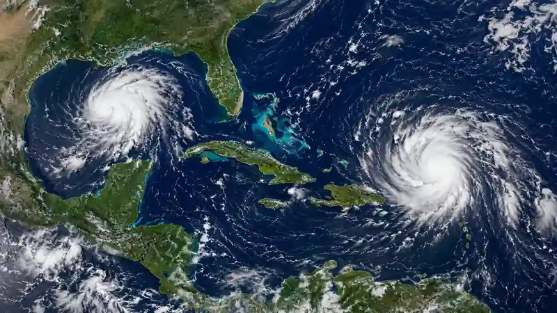

The National Hurricane Center is monitoring the remnants of Tropical Storm Dolly near the Caribbean while Invest 97-L drifts west across the northern Gulf. Neither system currently has a high chance of tropical development, but heavy rain and gusty weather remain possible in affected areas.
Dolly Remnants Move Into the Caribbean
Dolly became the fourth named storm of the 2026 Atlantic hurricane season before losing its closed circulation and becoming an open tropical wave. The National Hurricane Center ended regular advisories after the system became poorly organized.
By Saturday evening, showers and thunderstorms associated with Dolly’s remnants were about 150 miles east of the Leeward Islands. The system was moving west to west-northwest near 25 mph, with no signs of a new closed circulation.
Redevelopment was considered unlikely, with formation chances near 0% through 48 hours and 10% through seven days.
Heavy Rain Remains the Main Risk From Dolly
Even without regeneration, Dolly’s tropical moisture could bring locally heavy rain and gusty winds to parts of the Leeward Islands, the Virgin Islands and Puerto Rico. Flash flooding can become a concern where heavier rainfall reaches mountainous or poorly drained areas.
Wind shear and dry air have made it difficult for the system to reorganize. Longer-range model guidance may continue to shift as the remnants move west, so individual model tracks should not be treated as official forecasts.
Recent Hurricane Lala impacts in Hawaii showed why rainfall, flooding and wind impacts can still matter even when attention is focused on a storm’s track and intensity.
Invest 97-L Drifts West Across the Northern Gulf
A separate weak low-pressure area, Invest 97-L, was located roughly 125 miles south of Pensacola, Florida, in the Saturday evening update. It was producing showers and thunderstorms while drifting west across the northern Gulf.
Slow development remains possible. Formation chances were near 0% through 48 hours and 20% through seven days, giving Invest 97-L slightly higher longer-range odds than Dolly’s remnants.
The “Invest” designation simply identifies a disturbance being monitored more closely by meteorologists. It does not mean a tropical depression or named storm is certain to form.
Rain Chances Increase for Louisiana and Mississippi
For the northern Gulf Coast, rainfall is the more immediate concern. Tropical moisture associated with Invest 97-L could increase rain chances across Southeast Louisiana and South Mississippi from Sunday into Monday.
Some high-resolution model guidance has brought the disturbance or its moisture near Southeast Louisiana. However, its exact path and organization remain uncertain, making local forecasts more useful than relying on a single model run.
Even without tropical-storm formation, strong thunderstorms and heavy rain can disrupt roads and coastal communities. Previous Gulf Coast storm damage in Alabama showed how severe weather can affect travel and infrastructure without a hurricane making landfall.
The latest positions, development probabilities and official tropical outlooks are available from the National Hurricane Center.
Dolly and Invest 97-L Are Separate Systems
Although both appear on current tropical weather maps, they are unrelated disturbances. Dolly is the remnant of a previously named Atlantic storm moving through the Caribbean, while Invest 97-L is a separate low-pressure area in the Gulf that has not become a tropical cyclone.
For residents, the distinction between formation chances and weather impacts is important. A disturbance does not need a name to produce heavy rainfall, localized flooding or gusty winds.
Hawaii Schools Close as Powerful Kona Storm Brings Heavy Rain and Winds
Edmonton Emergency Alert Issued as Heavy Rain Strains Stormwater System
Why Low Development Odds Still Matter
The NHC percentages measure the chance of tropical cyclone formation, not the probability of rain at a particular location. Dolly and Invest 97-L therefore remain worth monitoring even with low development odds, especially where tropical moisture could affect travel or flood-prone communities.

Make Swikblog your go-to source on Google for reliable updates, smart insights, and daily trends.