Queensland is staring down a wet, volatile stretch of weather as a tropical low gathers influence over the state’s north, sharpening the risk of flooding, squally winds and storm bursts that can swing quickly from “manageable” to “messy.” For communities across Far North Queensland, the concern is less about a single downpour and more about repeated heavy rain bands that can load up creeks, push rivers higher, and turn familiar roads into brief no-go zones.
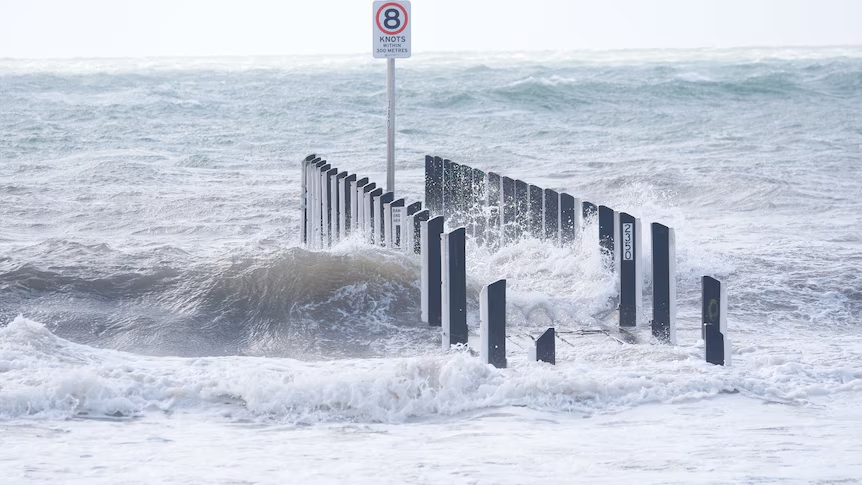
Weather watchers are tracking the system closely because tropical lows can organise fast, throwing out widespread rain while also nudging conditions that support stronger winds along the coast and nearby waters. That mix matters: saturated ground and gusty weather increases the odds of trees coming down, power interruptions and patchy localised impacts that don’t always show up evenly on a single forecast map.
A tropical low with flooding on the table
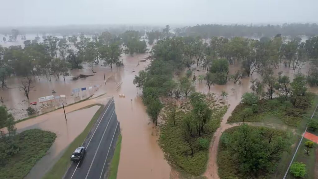
The core message for northern Queensland is straightforward: heavy rain is expected, and with it comes a meaningful flood risk. In the tropics, rainfall totals can stack up quickly when the atmosphere keeps refuelling the same corridor. Even where rain eases for a few hours, another burst can follow, especially overnight and into the next day when bands sweep back in.
For residents, the practical takeaway is that “flood risk” doesn’t only mean a major river event. Flash flooding can hit first, with rapid rises in creeks, water flowing over low crossings, and street-level flooding in drainage hot spots. If you live near a creek line, a flood-prone intersection, or a known dip in the road, this is the kind of setup where conditions can change abruptly.
Far North Queensland: wild weather, flash flooding and heavy winds
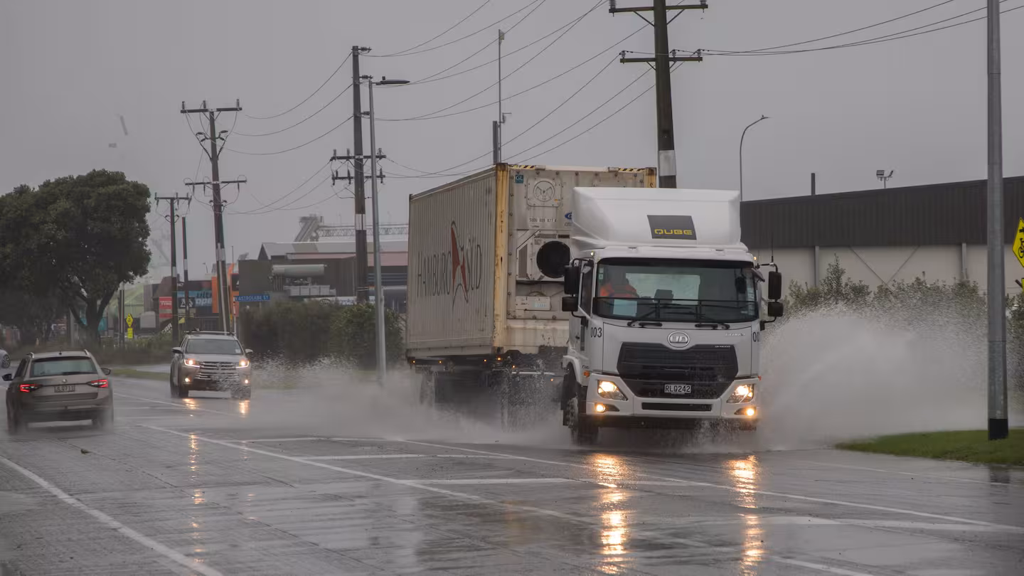
Across Far North Queensland, the expectation is for a rougher blend of weather: wild conditions marked by heavy rain and gusty winds, with flash flooding a realistic scenario where storms train over the same suburb or catchment. The wind component can be underappreciated in rain events, but it can be the difference between a wet day and a disruptive one—particularly if trees and branches come down on roads or lines.
In these setups, coastal communities often see the messiest combination: driving rain, squalls and periods of reduced visibility. Travel times can stretch, and the most common problems are rarely dramatic—they’re the slow grind of detours, temporary road closures, and water pooling in places that normally drain fast.
Brisbane’s outlook: storms in the south while cyclone talk hangs over the north
Further south, Brisbane’s forecast conversation is shifting toward rain with a chance of storms. That doesn’t mean Brisbane will wear the same severity as the far north, but it does suggest a more unsettled pattern—storm bursts, humid air, and rain periods that can interrupt commutes and school runs.
At the same time, the north is watching the broader “possible cyclone” chatter that sometimes follows tropical lows. Not every tropical low becomes a cyclone, and it’s common for systems to fluctuate in organisation. What matters for everyday life is the near-term impact already on the board: heavy rain and flood potential for northern districts, with stormier spillover possible further south.
Cairns and local readiness: water restrictions enter the conversation
In Cairns, local messaging has included a call for readiness around water restrictions. It may sound counterintuitive during a rain event, but it often reflects how infrastructure and water quality can be affected by extreme weather—heavy rainfall can muddy catchments, strain treatment systems, or complicate supply planning depending on local conditions.
The broader theme is preparedness at the council and community level: thinking about essential supplies, checking property drainage, and keeping an eye on updates if conditions escalate. When heavy rain and wind overlap, the risks are rarely limited to one category—transport, utilities, and local services can all feel the impact at once.
What to watch over the next 24 to 48 hours
If you’re following the system’s progression, the key signals are less about a single “peak moment” and more about the pattern: where rain bands set up, whether storms keep re-forming over the same areas, and how winds behave along the coast and nearby waters. Even moderate winds can become an issue when the ground is saturated and trees are already stressed.
For households and small businesses, the sensible checklist is simple: keep devices charged, avoid driving through water, allow extra time for travel, and stay alert to sudden downpours that can overwhelm gutters and drains. In flash-flood setups, the first hazard is often the most ordinary-looking: a shallow sheet of water across a road that hides a dip or current.
For the latest public updates and warnings from major coverage, follow the ongoing reporting via the Australian Broadcasting Corporation’s live weather updates, which are typically refreshed as conditions change.
Queensland’s wet-season reality: quick shifts, localised impacts
Queenslanders know the wet season can deliver a full range of outcomes, from a day of steady rain to a night of intense thunderstorms. Tropical lows are notorious for uneven impacts: one community might get persistent heavy rain while another sees only scattered showers. That’s why the most useful approach is local—watching your area’s warnings, rainfall bursts and nearby creek behaviour rather than relying on a single statewide picture.
For now, the clear message is to treat this as a meaningful rain event for the north, with flooding risk rising as the tropical low feeds moisture into the region. The difference between an inconvenient weekend and a dangerous one can come down to small decisions—whether you delay a drive, whether you move valuables off the floor, whether you keep a torch and batteries within reach.
You May Also Like
Make Swikblog your go-to source on Google for reliable updates, smart insights, and daily trends.