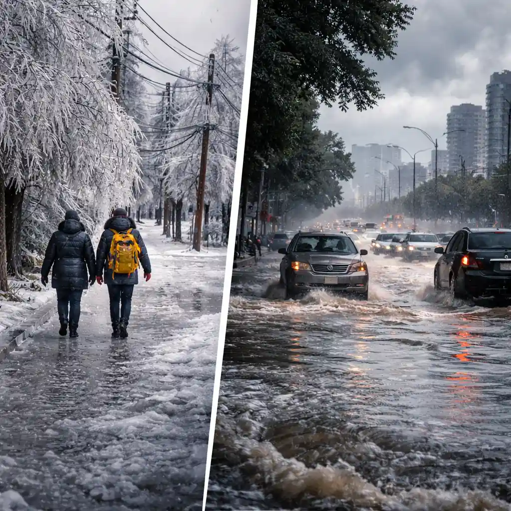
A powerful weather system is causing widespread disruptions across Ontario as a 24-hour ice storm threatens Ottawa while heavy rain floods several major roads across Toronto and the Greater Toronto Area (GTA). Authorities are urging residents to use extreme caution as freezing rain, dangerous driving conditions, and urban flooding impact thousands of commuters across the province.
Environment Canada has issued a freezing rain warning for Ottawa and eastern Ontario, warning that the storm could last up to 24 hours in some areas. At the same time, Toronto is experiencing heavy rainfall that could total up to 40 millimetres by the end of the day, already causing flooding on key roadways across the city.
Officials say the combination of icy roads in eastern Ontario and flooding in Toronto is likely to cause travel disruptions, flight cancellations, transit delays, and hazardous conditions throughout the day. Residents are being encouraged to stay updated through official forecasts from Environment Canada.
Freezing Rain Begins in Ottawa as Ice Storm Intensifies
Freezing rain began falling in Ottawa shortly after 8 a.m. Wednesday, according to Environment Canada observations at the Ottawa International Airport. Temperatures were recorded at around -1°C, creating conditions where rain freezes instantly on contact with surfaces.
The forecast calls for freezing rain throughout most of the day, with ice accumulation expected between 10 and 20 millimetres in eastern Ontario. Parts of western and southern Quebec could see even heavier ice accumulation ranging from 20 to 30 millimetres.
Meteorologists warn that prolonged freezing rain combined with moderate to strong winds could increase the risk of tree branches breaking and power lines sagging or snapping. Ice buildup on surfaces adds extra weight, and wind stress can cause significant structural strain on trees and electrical infrastructure.
The freezing rain is expected to transition to regular rain later in the evening as temperatures rise slightly above the freezing mark. However, overnight temperatures are forecast to drop again to around -3°C, bringing a 40 percent chance of flurries into Thursday morning.
Schools, Buses and Public Services Disrupted
The approaching ice storm has already forced multiple service disruptions across the Ottawa region and neighboring Quebec communities.
School transportation authorities cancelled school bus services across eastern Ontario and western Quebec due to dangerous road conditions. Schools in Ottawa remain open, but schools in Gatineau have been closed entirely for the day.
Algonquin College announced that its on-campus morning classes were cancelled across all campuses because of the severe weather forecast. Officials said campuses remain open, but a decision regarding afternoon classes will be announced later in the day.
Public facilities are also adjusting operations. All Ottawa Public Library branches are closed until noon, while the Metcalfe and Munster branches will remain closed for the entire day due to the storm.
Transit Delays Expected Across Ottawa
Ottawa’s public transit agency, OC Transpo, has warned riders to expect delays throughout the day as freezing rain affects road and rail operations.
The O-Train Line 1 is operating every four to five minutes during the morning commute to accommodate commuters, while O-Train Lines 2 and 4 are operating on their regular schedules.
Transit officials say icy infrastructure and slower road conditions for buses could impact service reliability during peak travel hours.
Flight Cancellations Reported at Ottawa Airport
Air travel is also feeling the effects of the storm. By mid-morning Wednesday, at least 20 departures and arrivals had been listed as cancelled or affected at Ottawa International Airport.
Airport officials are advising travellers to check the status of their flights before leaving home and to allow additional time to reach the airport safely.
Freezing rain can significantly slow airport operations as aircraft require de-icing procedures before takeoff, often creating delays even for flights that remain scheduled.
Police Warn Drivers After Dangerous Highway Incident
Police are urging residents to avoid unnecessary travel as road conditions deteriorate.
Ontario Provincial Police reported a driver traveling at 156 km/h on Highway 417 shortly before 9 a.m. while freezing rain was falling in Ottawa. Officers immediately issued a 30-day driving suspension and impounded the vehicle for 14 days.
The driver now faces a minimum $2,000 fine, six demerit points, and a potential one-year driving prohibition if convicted.
Authorities are warning drivers to slow down and remain alert for hazards including fallen tree branches, debris, and downed power lines. Residents are advised to stay clear of fallen electrical wires and report them immediately.
Toronto Roads Flooded as Heavy Rain Hits the GTA
While eastern Ontario deals with ice, Toronto is facing a different but equally disruptive weather threat. Heavy rainfall across the city has already caused flooding on several major roads as drainage systems struggle to keep up with the downpour.
Environment Canada says up to 40 millimetres of rain could fall across Toronto and the GTA by the end of the day.
Toronto police say they have received numerous calls reporting flooded roadways across the city. Some of the affected locations include:
- Gardiner Expressway at York Street
- Lawrence Avenue East at Railside Road
- Birchmount Road and Huntingwood Drive
- Northline Road and O’Connor Drive
Water accumulation has made some lanes difficult or impossible to pass, forcing drivers to slow down, divert, or turn back entirely.
Officials are warning motorists not to drive through flooded roads and to avoid low-lying areas where water levels can rise quickly. More guidance on flood safety can be found through the Weather Network.
Storm Impacts Could Last Beyond Wednesday
Weather experts say the system moving across Ontario is slow-moving, meaning its impacts may continue even after precipitation ends.
Environment Canada climatologist David Phillips warned that it may take one or two days for conditions to return to normal after the storm passes.
Ice accumulation in Ottawa could leave damaged trees and power lines, while Toronto may continue dealing with waterlogged roads and traffic delays as drainage systems recover.
Authorities across Ontario are encouraging residents to stay informed, avoid unnecessary travel, and prepare for rapidly changing weather conditions as the storm continues through the day.
Make Swikblog your go-to source on Google for reliable updates, smart insights, and daily trends.