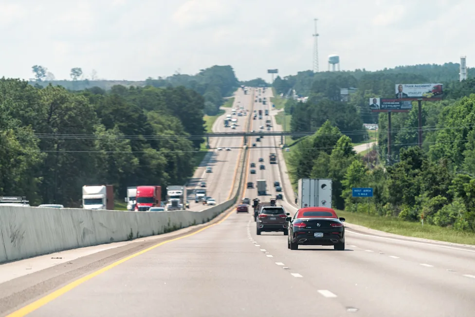
A powerful spring storm is set to sweep across Saskatchewan overnight, bringing a mix of heavy snow, strong winds, freezing rain, and rapidly changing travel conditions across much of the province. The system is expected to intensify late Tuesday night and continue through Wednesday, creating hazardous conditions for drivers and disrupting daily routines.
According to Environment and Climate Change Canada (ECCC), parts of central and southeastern Saskatchewan could receive between 10 and 15 centimetres of snow, while other areas may see a mix of rain and freezing rain. The combination of precipitation types and gusty winds could significantly reduce visibility and make road conditions unpredictable within a short period of time.
Heavy Snow Expected from Meadow Lake to Hudson Bay
The storm is forecast to impact a broad swath of the province, stretching from Meadow Lake in the west to Hudson Bay in the east. This region is expected to see the heaviest snowfall, although forecasters note that the exact placement of the most intense snow bands remains uncertain.
ECCC has stated that while pinpointing the exact corridor of maximum snowfall is difficult, “significant accumulations are likely in some areas.” This uncertainty means that communities slightly outside the main forecast zone could still experience higher-than-expected snowfall totals depending on how the system develops overnight.
Saskatoon is among the major cities likely to be affected, with snowfall totals reaching up to 10 centimetres through Wednesday. The timing of the storm could impact both morning and evening commutes, increasing the risk of slow traffic, minor accidents, and delays across the city.
Regina to See Rain and Freezing Rain Instead of Snow
Unlike Saskatoon and other central regions, Regina is expected to largely avoid heavy snowfall. However, that does not mean conditions will be easier. Forecasters predict a mix of rain and freezing rain in the capital, which could create icy roads and sidewalks.
Freezing rain is particularly dangerous because it forms a thin, nearly invisible layer of ice on surfaces. This increases the risk of vehicle skidding, pedestrian falls, and travel disruptions. Drivers in Regina and surrounding areas are being advised to remain cautious, especially during early morning and late evening hours when temperatures are more likely to dip below freezing.
Strong Winds Up to 50 km/h to Reduce Visibility
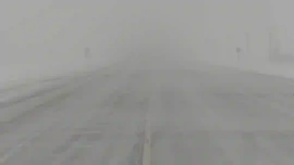
One of the most significant concerns with this storm is not just the snowfall, but the wind. Gusts of up to 50 kilometres per hour are expected in some areas on Wednesday, which could lead to blowing snow and sharply reduced visibility.
Blowing snow can create near-whiteout conditions on highways, particularly in open rural areas where there are few natural wind barriers. This can make it difficult for drivers to see lane markings, other vehicles, or sudden changes in road conditions.
Environment Canada meteorologists have warned that visibility could change rapidly, turning otherwise manageable driving conditions into dangerous situations within minutes.
Freezing Rain Risk in Southeastern Saskatchewan
Communities in southeastern Saskatchewan, including Estevan and Weyburn, could experience freezing rain as the storm system evolves. This adds another layer of risk, as ice accumulation can make roads extremely slippery and increase the likelihood of accidents.
The combination of freezing rain followed by snow in some areas may also create compacted, icy road surfaces that are difficult to clear quickly. Residents in these regions are urged to remain alert and avoid unnecessary travel if conditions deteriorate.
Travel Advisory Issued as Conditions Change Rapidly
Officials are strongly advising residents to check road conditions before travelling, as weather and visibility could shift quickly throughout the night and into Wednesday. Drivers are encouraged to delay travel if possible, especially during peak storm hours.
For those who must travel, safety precautions such as reducing speed, maintaining a safe following distance, and allowing extra travel time are essential. Up-to-date highway conditions can be accessed through the Saskatchewan Highway Hotline, which provides real-time updates on road closures, visibility issues, and driving conditions.
Meteorologist Danielle Desjardins emphasized the importance of caution, noting that rapidly changing conditions could catch drivers off guard. Even familiar routes may become hazardous as snow accumulates and winds pick up.
Snow to Ease Late Wednesday, Cold Temperatures to Follow
The storm is expected to gradually weaken late Wednesday, although light snowfall could persist into Thursday morning in some areas. Despite the tapering precipitation, colder air will settle across the province.
Daytime temperatures are forecast to remain below 0°C across much of Saskatchewan during the storm, helping snow and ice remain on roads and surfaces for longer periods. This could extend travel challenges even after snowfall begins to decrease.
However, the cold snap is not expected to last. Warmer conditions are forecast to return by the weekend, bringing a much-needed break from winter-like weather and helping snow begin to melt.
Residents can stay updated on evolving forecasts and warnings through Environment and Climate Change Canada, as weather patterns on the Prairies can shift quickly depending on storm track and temperature changes.
Spring Storm Highlights Unpredictable Prairie Weather
This storm serves as a reminder that spring weather across Saskatchewan can be highly unpredictable. While many residents may have already started transitioning to warmer conditions, late-season storms like this can still bring significant disruptions.
The combination of heavy snow, strong winds, freezing rain, and below-freezing temperatures makes this system particularly impactful despite being a spring event. The timing of the storm, especially overnight and during midweek travel hours, further increases its potential to disrupt daily life.
As the system moves through the province, residents are encouraged to stay informed, plan ahead, and prioritize safety. While conditions are expected to improve later in the week, the next 24 to 36 hours could bring challenging weather across multiple regions of Saskatchewan.
You may also like: Ottawa Crossing Guard Killed in Hit-and-Run Involving Ford F-150
Make Swikblog your go-to source on Google for reliable updates, smart insights, and daily trends.