Ireland is waking up to dangerous weather conditions as Storm Bram brings Orange wind warnings, torrential rain, coastal flooding risks and the prospect of widespread travel disruption and power cuts across much of the country.
A rapidly deepening Atlantic low-pressure system, named Storm Bram by Met Éireann, is moving across Ireland today with very strong to gale-force southerly winds and bands of heavy rain. Two Status Orange wind warnings have been issued for 18 counties, including Cork, Kerry, Waterford and Wexford early this morning, with further Orange alerts for parts of the west, northwest and midlands later in the day.
Met Éireann’s latest commentary warns that Bram will bring “strong winds, high coastal water levels and periods of heavy rainfall”, with the risk of coastal flooding at high tide and surface flooding on already saturated ground. You can read the full meteorological briefing on the Met Éireann website .
In addition, a nationwide Status Yellow wind warning is in place until tonight, alongside Yellow rain alerts for several southern counties, after a week of persistent rainfall has left soils and rivers close to capacity. An RTÉ update on the evolving warning situation is available via their latest Storm Bram coverage .
Power cuts, falling trees and “multi-hazard” conditions
Local authorities and emergency services describe Bram as a “multi-hazard event”, with the main risks coming from damaging wind gusts, falling trees, power-line damage, spot flooding and hazardous seas. Gusts of over 120 km/h are possible in exposed coastal locations, with some high ground and headlands likely to see even stronger bursts.
ESB Networks crews have been placed on standby in the south and west, where the combination of waterlogged ground and severe winds makes it easier for trees to topple onto lines. Coillte has also urged the public to avoid forests and walking trails in Orange warning areas during the storm, noting the risk of falling branches and unstable trees as winds peak. Their statement can be read in full on the Coillte website .
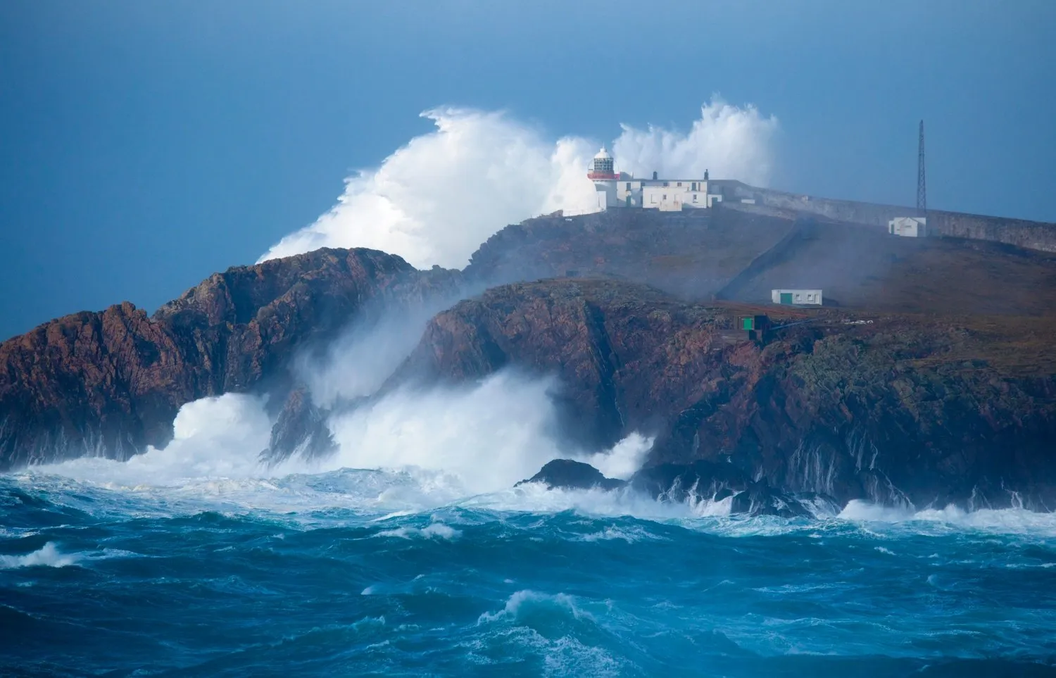
Met Éireann has also issued a Status Red Marine Warning for western coastal waters, where violent storm-force winds and very high seas are expected. Coastal flooding is considered likely along parts of the south and west coasts around morning high tide, and along eastern shores later in the day as the system tracks northeast.
You May Also Like
Travel disruption: roads, public transport and ferries
Commuters are being advised to allow extra time for journeys and to avoid non-essential travel in the worst-affected areas. Strong crosswinds, standing water and debris on roads are likely to create difficult and in some places dangerous driving conditions.
Transport for Ireland has warned of possible delays and cancellations across bus and rail services, particularly in coastal and western counties, and has encouraged passengers to check for live updates before travelling. The agency’s dedicated advisory for this storm, including the latest service information, is available on the Transport for Ireland website .
Ferry operators in the Irish Sea and on western routes are also monitoring conditions closely, with some early sailings either cancelled or operating with restrictions due to high seas and strong gusts. Passengers are advised to check directly with ferry companies for the latest status before departure.
How Storm Bram is hitting the UK too
While Ireland bears the brunt of this morning’s strongest winds, Bram is also bringing severe weather to neighbouring UK regions. The UK Met Office has issued a series of Yellow and Amber warnings for wind and rain across parts of Wales, Scotland, Northern Ireland and western England, with forecasters warning of 90 mph gusts, flooding and “danger to life” in some areas. More details on these warnings are available via the Met Office Storm Bram update and live coverage from Sky News .
Safety advice: what people in Ireland should do today
- Avoid seafronts, piers and exposed coastal walks during peak winds and high tide.
- Limit non-essential travel, especially in Orange warning areas or where surface water and debris are already reported.
- Secure loose items such as bins, garden furniture, trampolines and decorations that could become airborne in strong gusts.
- Prepare for possible power cuts by having torches, charged power banks and essential medications readily available.
- Keep following updates from Met Éireann’s warning page, local councils, Gardaí and emergency services throughout the day.
As always with fast-evolving Atlantic storms, warnings and timing may be updated at short notice. Staying informed via official channels and taking simple precautions can significantly reduce the risks from what forecasters say has the potential to be an “impactful event” across much of Ireland.
Make Swikblog your go-to source on Google for reliable updates, smart insights, and daily trends.