Written by Jordan Mitchell
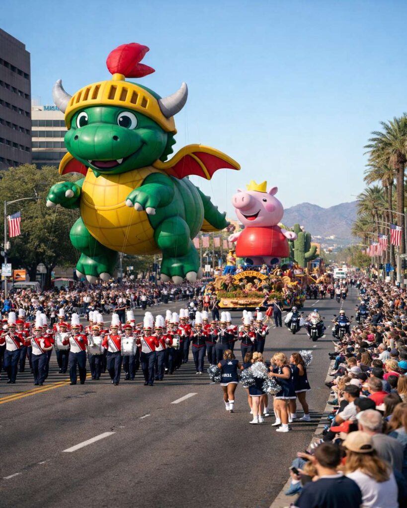
The 53rd annual Vrbo Fiesta Bowl Parade rolls through central Phoenix on Saturday, Jan. 3, 2026, bringing a packed morning of marching bands, community groups, floats and family-friendly fun — along with major street restrictions. Here’s a clear, practical guide to the route, start time, closures, parking, and best ways to get around.
At a glance
- Date: Saturday, Jan. 3, 2026
- Start time: Around 10:00–10:05 a.m.
- Route: Central & Montebello → south on Central → east on Camelback → toward Seventh Street
- Road closures: Begin as early as 6 a.m.; many reopen around 2 p.m.
- Cost: Free to watch from the street
- Televised: Local broadcast on Arizona’s Family 3TV
What time does the parade start?
Expect the parade to step off around 10 a.m., with some reports listing a 10:05 a.m. start after pre-parade programming. The procession typically runs late morning into early afternoon, so the busiest traffic window is usually mid-morning through early afternoon.
Fiesta Bowl Parade 2026 route
The parade begins at Central Avenue and Montebello Avenue, heads south on Central to Camelback Road, then turns east on Camelback toward Seventh Street. The full route is roughly about 2 miles, and viewing is available along the entire path on a first-come basis.
For official parade details and updates, start with the Fiesta Sports Foundation’s parade page: Vrbo Fiesta Bowl Parade (Fiesta Sports Foundation) .
Phoenix street closures and restricted areas
Roads along the parade route are expected to be closed to outside traffic. Many restrictions run from about 6 a.m. to approximately 2 p.m., and the city may also restrict bike lanes in portions of the corridor.
Commonly listed closures include:
- Central Ave. (Rose Lane to Missouri Ave.)
- Central Ave. (Missouri Ave. to Camelback Road)
- Missouri Ave. (Seventh Ave. to Seventh St.)
- Bethany Home Road (Seventh Ave. to Seventh St.)
- Camelback Road (Seventh Ave. to 16th St.)
- Seventh St. (Colter St. to Indian School Road)
If you want a second easy-to-read local guide for the same closure list and viewing tips, Phoenix New Times has a helpful roundup here: Phoenix New Times: Fiesta Bowl Parade route, closures, best viewing info .
Parking: where to leave your car
There’s no single official “parade parking lot”, so plan for a mix of street parking and nearby paid options. Street parking around the route is generally first-come, first-served, and it fills up quickly on parade morning.
Some nearby churches, businesses, and private lots may offer paid parking (availability varies). A commonly noted paid option is parking at First United Methodist Church, typically accessed by traveling eastbound on Missouri Avenue.
Best viewing spots and comfort tips
The simplest rule: arrive early. The route offers strong sightlines throughout, but the most popular stretches usually fill first.
- Central Avenue stretches can provide long views of floats and bands as they roll south.
- Camelback Road is often lively and can be easier for meeting up with friends afterward.
- Bring water, a folding chair, and sun protection, even in mild winter weather.
- Portable restrooms are typically placed along the route.
Can you watch it on TV?
Yes — if you’d rather skip traffic, the parade is scheduled to air live locally on Arizona’s Family 3TV (and related local sports channels).
Who’s the grand marshal?
The 2026 grand marshal is Nikki Bella, the WWE star and Arizona native. Expect additional family-friendly parade attractions, including special character appearances and marching bands from across the U.S.
Smart driving plan: how to avoid the worst congestion
- If you must drive through the area, aim to be in place before 9 a.m. or wait until after early afternoon.
- Use major cross-streets outside the closure zone and expect last-second police-directed detours.
- Consider rideshare drop-offs well outside the route, then walk a few blocks to a viewing spot.
- If you’re meeting friends, pick a landmark away from the tightest closures to avoid getting split by barricades.
More from Swikblog
For more local explainers, travel-friendly guides, and sports-weekend coverage, visit the Swikblog homepage.
Make Swikblog your go-to source on Google for reliable updates, smart insights, and daily trends.