A damp start, a chilly “real feel,” and a wintry edge creeping back into the forecast later this week.
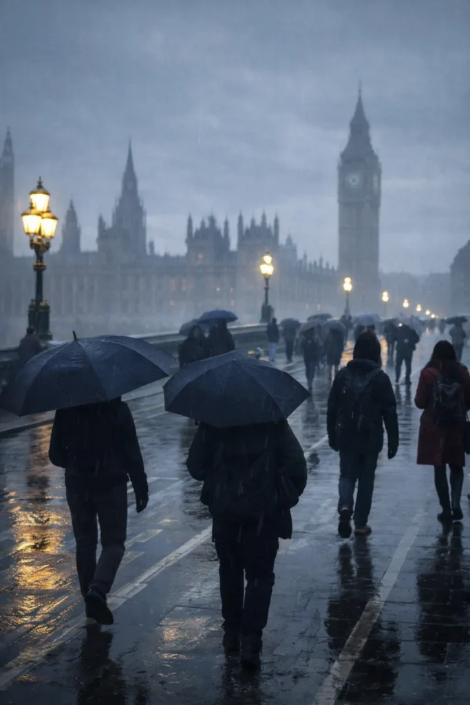
London is waking up to a familiar winter mix: low cloud, a cool breeze and that sharp “feels like” temperature that makes the city seem colder than the thermometer suggests. While the air temperature is hovering around 6°C, the combination of cloud cover and wind is pushing the real feel closer to 2°C. It’s the kind of morning where damp air clings to coats, pavements stay slick, and a short walk can feel longer than it should.
The headline risk today is rain moving in later, but it’s not expected to be wall-to-wall wet for everyone. Forecast guidance points to variable cloud with brighter spells early, then showers or spells of rain arriving in the afternoon. Some parts of London will dodge the worst of it, while others catch a quick burst that’s enough to soak commuters and turn streets shiny again. By evening, conditions are expected to turn largely clearer, setting the stage for a noticeably colder night.
The numbers behind today’s feel are straightforward: a moderate breeze around 16 kph and high humidity (around mid-80%) make the air feel heavier and cooler. That’s why the city can read “6°C” and still feel closer to freezing when you’re waiting at a bus stop or crossing a breezy bridge. Daytime temperatures are expected to top out around 8–10°C, with a low near 3°C overnight.
Tonight is when the pattern shifts. As lingering cloud breaks and clears out in the early hours, London is set for a clearer, drier stretch—but the trade-off is colder air pooling near the ground. That typically means a sharper chill by late evening and early morning, especially in more open areas and on the edges of the city where temperatures can dip a little lower than central streets.
Tuesday brings a calmer, brighter story at first. After a cold night, the day is expected to start dry and crisp with some sunshine breaking through. Later in the afternoon, a band of higher cloud may drift in before thicker cloud builds from the southwest, but the key point is that it should stay largely dry. Highs are likely around 7–8°C with an overnight low near 1–2°C, keeping the “cold morning, tolerable afternoon” rhythm intact.
The more consequential change arrives midweek. Wednesday is expected to start cloudy but still mostly dry. The break in cloud later in the day may offer a few clearer spells, but the evening carries the bigger signal: heavier rain spreading in from the south, with the added risk of sleet and hill snow developing as colder air mixes in. In London itself, that often shows up first as cold rain that briefly turns more wintry in heavier bursts—especially after dark and in areas that cool quickly.
Thursday continues that unsettled edge early on, with patchy rain and sleet possible before conditions trend drier and brighter later. That kind of stop-start day can be deceptively disruptive: roads may look fine one moment, then a brief wintry shower rolls through and drops visibility, chills the air, and leaves surfaces damp again. By the afternoon, brighter intervals should return, but the air will still feel winter-sharp.
Friday is shaping up as a reset button—at least at first. Expect a dry and bright start before cloud thickens later. It’s the sort of day that can begin with a clean, crisp look to the skyline and end under a grey lid again, without necessarily bringing constant rain. Temperatures should remain seasonably cool, with the real feel still influenced by wind and lingering dampness.
So what should Londoners watch for? Today’s rainfall looks more likely to be timed around the afternoon rather than a continuous washout, and tonight’s clearing is a quiet signal that the city is stepping into a colder phase. The midweek sequence is the one that matters most: rain Wednesday evening, a wintry mix risk as temperatures hover near freezing levels, then a gradual improvement later Thursday into Friday.
For the most authoritative, up-to-date local guidance and warnings, it’s worth checking the official forecast directly via the Met Office forecast for London.
More on Swikblog: Latest updates
Make Swikblog your go-to source on Google for reliable updates, smart insights, and daily trends.