Updated: February 17, 2026
An out-of-control bushfire near the Tallarook Ranges has triggered urgent warnings for central Victorian towns, as extreme heat and gusty winds push fire danger higher across the state.
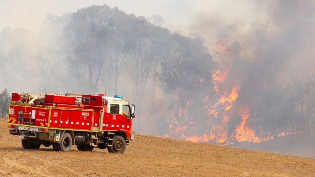
A rapidly escalating bushfire in central Victoria has prompted a stark survival message for residents in the path of the flames: take shelter indoors immediately. Emergency services say conditions around the fire are so dangerous that, for some communities, it is too late to evacuate. The blaze is burning near Trawool at the base of the Tallarook Ranges, just as Victoria enters a day of extreme fire danger and soaring temperatures.
EMERGENCY WARNING – BUSHFIRE – Take Shelter Now – Kerrisdale, Trawool
— VicEmergency (@vicemergency) February 17, 2026
More details at https://t.co/WkrLBuoJEo pic.twitter.com/17mlX7PStx
The timing could not be worse. Forecasts show Melbourne is set to reach 37°C, with hot, dry winds and gusts up to 60km/h heightening the risk that any fire will run hard and become difficult to contain. After a summer already marked by major fire losses, the latest emergency is raising fresh fear across central Victoria.

‘You are in danger’: urgent shelter warning for towns near Seymour
Residents of Kerrisdale, Tallarook and Trawool — about 15 kilometres south of Seymour — were urged to act immediately as the fire threatened lives. The warning message was blunt: those in the immediate area should shelter indoors because it was too late to leave safely. Officials emphasised that survival depends on quick action, with changing winds and heavy fuel loads capable of turning a fire front into a fast-moving threat within minutes.
Fire authorities also issued a “watch and act” warning further south for people near King Parrot Creek Road from Tehans Road to Strath Creek Road, urging residents to leave while routes remained open. In that zone, the message shifted from immediate shelter to early movement: leave now before conditions deteriorate and escape becomes impossible.
Why this fire is proving hard to fight
Crews face a tough battle because sections of the blaze are burning in inaccessible country, limiting what ground firefighters can do. Authorities say multiple aircraft are working the fire, a sign of how quickly conditions have intensified. When heat peaks and winds strengthen, aircraft can be critical for slowing runs and protecting communities, but they cannot replace the need for safe access and favourable weather.
Across the state, the concern is that a single ignition can turn into a major incident under today’s mix of heat, dry vegetation, and gusting winds. Emergency managers warned that if a fire starts, it may be difficult to contain, particularly across grasslands and areas carrying heavy fuel after weeks without meaningful rain.
Heat forecast across Victoria as Melbourne climbs
The state is bracing for widespread heat in the mid-thirties. Forecasts point to Melbourne hitting 37°C and Mildura also reaching 37°C. Seymour, Bendigo and Wangaratta are expected to reach 35°C, while Geelong and Bairnsdale are forecast around 36°C, and Ballarat around 32°C. A cooler change is expected later, but not before Victoria passes through the most dangerous part of the day.
Thunderstorms are also possible across parts of central and western Victoria, increasing the risk of lightning ignitions. For fire agencies, that combination is particularly volatile: heat dries fuels, wind drives spread, and storms can introduce new outbreaks with little warning.
Total fire bans declared across multiple districts
A total fire ban has been declared for the Central district (including Melbourne, Geelong and Ballarat), North Central, Southwest, West, South Gippsland and Wimmera districts. Under a total fire ban, no fire can be lit in the open air or allowed to remain alight. Authorities say the ban reflects the reality on the ground: extreme conditions mean even a small spark can become a dangerous emergency.
If you are in Victoria and need official, live emergency warnings and incident maps, check VicEmergency for the latest advice in your area.
The shadow of January’s fire season
The new blaze is burning just kilometres from where a major fire caused devastation in January. That earlier incident burned through more than 100,000 hectares of land and took weeks to contain. Across January, fires burned more than 400,000 hectares in Victoria, with one fatality reported and nearly 1,600 structures damaged or destroyed after fires were aggravated by extreme heat early in the month.
For communities still recovering, another high-risk day brings an added emotional burden. The geography of central Victoria — grasslands, forest edges, and changing wind corridors — can create rapidly shifting fire behaviour. Authorities have repeatedly stressed that the key to survival is acting early and following warnings without delay.
Next session watchlist: what to monitor
As conditions evolve through the afternoon and into the evening, the biggest factors to watch are wind direction changes, the timing of any cool change, and any new thunderstorm activity that could spark additional fires. Pay close attention to “take shelter” and “watch and act” updates, and keep devices charged in case power outages affect communications. If you’re outside the warning zones but in high-risk districts, avoid travel near bushland and grassland corridors and stay ready to enact your bushfire plan.
For more breaking updates across weather and major incidents, follow Swikblog.
Make Swikblog your go-to source on Google for reliable updates, smart insights, and daily trends.