A dangerous spell of weather is set to hit New Zealand’s upper North Island within hours, with authorities issuing heavy rain warnings and watches as a slow-moving subtropical system threatens flooding, slips and widespread disruption across multiple regions.
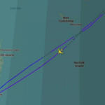
MetService has placed Northland under an orange heavy rain warning from 10pm Monday until 4pm Tuesday, alongside a strong wind watch from 3am Tuesday. At the same time, Auckland, Coromandel and Bay of Plenty are under heavy rain watches, with forecasters warning conditions could escalate further.
The system is already drawing attention due to its scale and uncertainty. Meteorologists say the country is currently “sandwiched” between a broad low-pressure system moving down from the northwest and a blocking ridge of high pressure, slowing the system’s movement and increasing the risk of prolonged rainfall.
Northland is expected to bear the brunt initially, with forecasts pointing to 90mm to 120mm of rain, particularly across northern and eastern areas. Given that parts of the region are still recovering from severe flooding in late March, the additional rainfall could quickly overwhelm saturated ground and drainage systems.
The risk is not limited to rainfall totals alone. Authorities have warned that streams and rivers may rise rapidly, increasing the likelihood of surface flooding, slips and hazardous driving conditions, particularly during peak downpours overnight and into Tuesday.
Further south, the situation is evolving. A separate heavy rain watch has been issued for Bay of Plenty and Rotorua, covering areas west of Whakatāne, from 3pm Tuesday through to 6pm Wednesday. Forecasts suggest rainfall could exceed warning thresholds, with a high probability the watch may be upgraded.
This creates a rolling weather event rather than a single burst of rain, extending the window of risk across multiple days and regions. For residents and businesses, that increases the likelihood of cumulative impacts rather than isolated disruptions.
Compounding the situation is the presence of Tropical Cyclone Vaianu near Fiji, which forecasters are closely monitoring. While its direct path remains uncertain, any interaction with the existing system could intensify rainfall or prolong wet conditions across New Zealand.
Forecast uncertainty remains a central concern. Meteorologists have described weather models as “jumpy,” with varying projections on where the heaviest rainfall bands will settle. This means some areas currently under watch could see conditions worsen quickly if the system shifts.
Why this system is different
Unlike fast-moving fronts that pass within hours, this system is expected to move slowly due to the blocking high-pressure ridge. That allows it to pull sustained moisture from the subtropics, feeding repeated waves of rain across the eastern seaboard.
This pattern significantly increases flood risk because rainfall accumulates over time rather than dispersing. Even moderate bursts, when repeated over several hours, can lead to rapid water build-up in already saturated regions.
The timing is also critical. With Northland still recovering from recent flooding, infrastructure and soil conditions are more vulnerable than usual. What might otherwise be manageable rainfall could now trigger more severe outcomes.
Authorities are urging residents to take precautionary steps, including clearing drains and gutters, avoiding low-lying flood-prone areas and exercising caution while driving. Emergency services are also expected to remain on alert as conditions develop.
The broader concern is the potential for disruption across transport, agriculture and local economies, particularly if flooding or slips affect key routes. Past events have shown that even localized damage can ripple into wider supply and mobility issues.
With warnings already in place and watches likely to evolve, attention is now focused on how the system unfolds through Tuesday and Wednesday. Updated forecasts and alerts are expected as meteorologists track the interaction between the subtropical low and surrounding pressure systems via MetService.
For now, the message from forecasters is clear: severe weather is on the way, but the exact scale and location of its impact will only become clearer as the system moves closer to land.
You may like: Qantas flight makes emergency mid-air return after fuel dump on Sydney-Dallas routeMake Swikblog your go-to source on Google for reliable updates, smart insights, and daily trends.