
HONOLULU — Hurricane Lowell is closing in on Hawaii’s western islands Monday, putting Kauai and Niihau under a Hurricane Warning as residents and visitors prepare for damaging winds, flooding rain, dangerous surf and an unusual tornado threat.
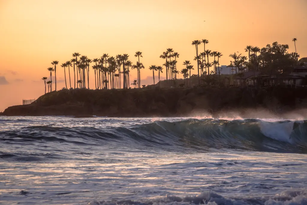
Laguna Beach emergency: Laguna Beach has declared a local emergency after powerful swells linked to former Hurricane Marie stripped large amounts of sand from beaches and accelerated coastal erosion. The declaration allows the city to move faster on shoreline protection, sand placement, debris removal, inspections and repairs.
Severe erosion: City officials say the sand loss has been unusually extensive, leaving some stretches of coastline dramatically altered and increasing concern for oceanfront homes and public infrastructure.
Homes affected: Six oceanfront homes along Ocean Way and Lagunita Drive have been yellow-tagged because seawalls protecting the properties were compromised.
Beach closures: The south end of Lagunita Beach, Pearl Street Beach, the footpath at Christmas Cove and portions of Aliso Beach remain temporarily closed because of erosion and unsafe conditions.
Aliso Beach: Part of the Aliso Beach parking lot has failed following repeated wave action and shoreline loss, adding to infrastructure concerns along the Orange County coast.
Dana Point: The broader Southern California surf event has also damaged beachfront property in Dana Point, where hundreds of large boulders have been brought in as an emergency barrier against further wave damage. NBC Los Angeles reported seven homes were red-tagged after destructive surf damaged decks and other parts of residences.
Long Beach: About 20 homes along the Long Beach Boardwalk were evacuated earlier in the week as high surf pushed water inland. Fire officials reported damage to at least 12 garages while crews inspected homes and soil erosion.
Winter concern: Laguna Beach officials are preparing for the possibility that additional North Pacific storms during the coming El Niño season could worsen erosion before beaches have time to naturally rebuild.
Current focus: The immediate hurricane threat has passed, but coastal erosion, damaged seawalls, vulnerable homes and weakened shoreline infrastructure remain the major concern across parts of Southern California.
🔴 Latest Update Updated: September 9, 2026 • 7:25 a.m. IST
Massive waves from Tropical Storm Marie battered the Southern California coast over Labor Day weekend, causing minor coastal flooding and forcing some beachfront homes to evacuate. pic.twitter.com/jTtU5AT3tZ
— Breaking911 (@Breaking911) September 8, 2026Hawaii: Hurricane Lowell has passed west of Kauai and Niihau and is moving away from the islands. Attention has shifted to damage assessment, power restoration, debris removal and recovery operations.
Warnings: The Hurricane Warning for Kauai County has been canceled, although dangerous surf, flooding impacts and other hazards may continue in affected areas.
Kauai impacts: Lowell brought damaging winds, heavy rain, coastal surge, downed trees and widespread power outages. Crews continue assessing infrastructure and property damage.
Southern California: Powerful swells generated by former Hurricane Marie have battered beaches in Dana Point and Long Beach, damaging oceanfront homes and coastal infrastructure.
Dana Point: At least 14 homes have been reported damaged around Capistrano Beach. Dana Point’s latest official update listed six homes as red-tagged and two as yellow-tagged after waves damaged decks and undermined foundations.
Long Beach: Roughly 20 oceanfront homes were evacuated after powerful surf damaged coastal defenses and cracked sections of the boardwalk along the Peninsula.
Emergency work: Crews and property owners are using emergency coastal protection measures, including sandbags and boulders, as vulnerable areas remain exposed to high tides and additional surf.
Injuries: No injuries have been reported from the Southern California coastal damage. Officials continue monitoring affected homes and shoreline conditions.
dir=”ltr”>Hurricane Lowell is approaching Hawaii as a Category 3 storm, prompting hurricane warnings for Kauai and bringing the threat of life-threatening conditions, hurricane-force wind gusts, dangerous surf, and rip currents.
Forecasters warn the storm could pass within about 100 miles… pic.twitter.com/1vvIO8WhZa— Fox News (@FoxNews) September 7, 2026
Storm: Hurricane Lowell — 110 mph winds
Location: About 135 miles southwest of Līhuʻe at 8 p.m. HST
Track: Moving north-northeast at 18 mph; core expected near or just west of Niihau overnight into early Tuesday
Warnings: Hurricane Warning for Kauai and Niihau; Tropical Storm Warning for Oahu
Rain: Maximum storm totals could reach 24 inches on Kauai, raising the risk of significant flash flooding and mudslides
Storm surge: 2–4 feet possible in Kauai County, with large and destructive waves
Tornado threat: Several tornadoes possible near Kauai and Niihau overnight
Closures: Kauai County government offices, public schools, Kauai Community College and Judiciary facilities are closed Tuesday.
Lowell remained a Category 3 hurricane with maximum sustained winds of 115 mph early September 7. At 2 a.m. HST, the storm was about 415 miles southwest of Lihue and 445 miles southwest of Honolulu, moving north-northeast at 10 mph. Rainbands were already spreading across Kauai and Oahu.
The center is forecast to pass just west of the main Hawaiian Islands late Monday. But a track offshore does not eliminate the danger: hurricane-force winds extend outward up to 60 miles from Lowell’s center and tropical-storm-force winds up to 175 miles.
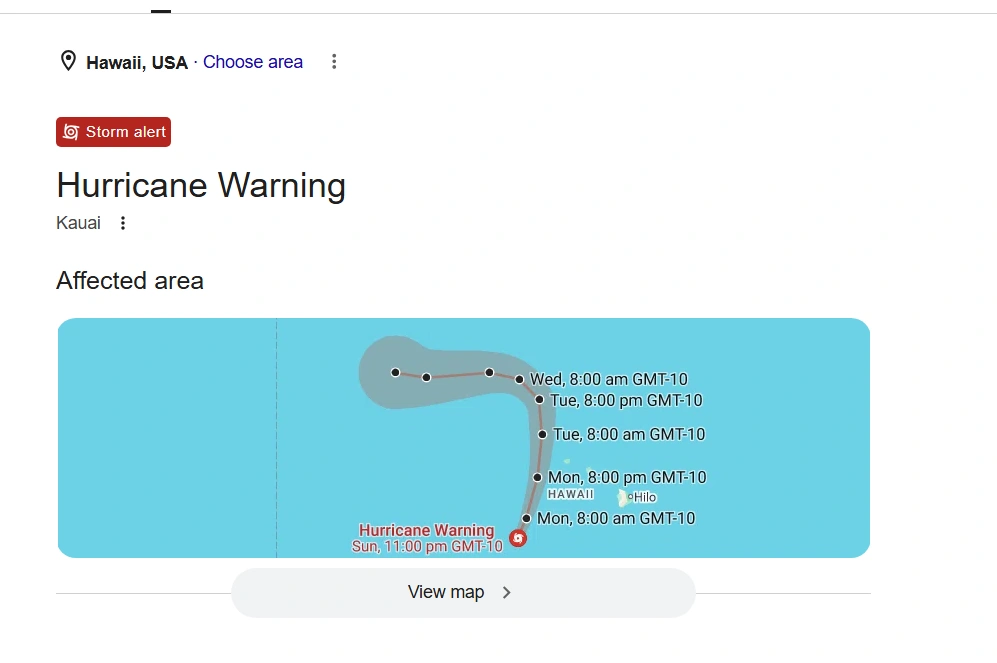
Kauai and Niihau under Hurricane Warning
A Hurricane Warning covers Kauai County, including Kauai and Niihau, with hurricane conditions expected beginning Monday afternoon or evening.
The National Hurricane Center has urged people in the warning area to complete preparations to protect life and property. Lowell is expected to weaken gradually but remain a hurricane during its closest approach to Hawaii.
Residents should not focus solely on the forecast center line. Hawaii’s mountainous terrain can amplify winds at higher elevations and exposed locations, while Lowell’s rainbands and swells extend far from its eye.
When will Hurricane Lowell be closest to Kauai?
The most dangerous period for Kauai and Niihau is expected from Monday afternoon through Monday night into early Tuesday.
That window could bring overlapping hazards, including strong winds, torrential rain, coastal flooding and rotating thunderstorms. Lowell is then forecast to move away from Hawaii and turn toward the northwest.
Kauai could receive up to 14 inches of rain
Flooding could become one of Lowell’s biggest threats. Kauai could receive 6 to 10 inches of additional rain, with isolated totals reaching 14 inches.
The Big Island could receive 4 to 8 inches with isolated 12-inch totals. Oahu could see 4 to 6 inches with isolated totals near 8 inches, while Maui could receive 2 to 4 inches with localized totals reaching 8 inches.
Heavy rain could trigger significant flash flooding, rapidly rising streams and mudslides, particularly in steep terrain.
Hawaii has seen how quickly extreme rain and wind can disrupt infrastructure. Earlier this year, a major Hawaii storm left more than 139,000 customers without power as severe weather affected communities across the islands.
Why is there a tornado threat in Hawaii?
Lowell is bringing an especially unusual hazard for the state: several tornadoes are possible around Kauai and Niihau Monday afternoon through Monday night. A few could also occur elsewhere across Hawaii.
Hurricane rainbands can produce short-lived tornadoes when winds change speed or direction with height. Waterspouts may also form offshore and can become tornadoes if they move onto land.
Tornadoes are rare in Hawaii. National Weather Service historical data cited by meteorologists recorded only 42 tornadoes statewide between 1950 and 2018. Most are relatively weak, but even brief tornadoes can damage roofs, trees and utility lines.
The tornado threat should decrease quickly early Tuesday as Lowell moves north of the islands.
20- to 30-foot surf and coastal flooding
Large swells from Lowell are creating another danger along Hawaii’s coastline. Surf along exposed south- and west-facing shores of Kauai and Niihau could build to around 20 to 30 feet.
Storm surge could raise water levels 1 to 3 feet above normally dry ground in Kauai County, while Oahu could see up to one foot. Large waves on top of elevated water could worsen coastal flooding and erosion.
Life-threatening surf and rip currents are expected, meaning beaches can remain dangerous even if Lowell’s eye never crosses land.
Five refuge areas open on Kauai
Kauai County has opened five refuge areas: Kīlauea Neighborhood Center, Kapaʻa Middle School, Kauaʻi High School Gym, Kalāheo Neighborhood Center and Waimea Canyon Middle School.
These locations are not fully supplied shelters. People using them should bring food, water, bedding, medicines and other essentials. Pets are permitted, but owners need their own pet supplies and appropriate carriers.
National Hurricane Center Tracks Dolly and Invest 97L in the Gulf
France Tornado 2026: 41 Injured and 300 Homes Damaged in Pomas
Parks, campgrounds and Kalalau Trail closed
All Kauai County parks and campgrounds are closed. Polihale State Park and Nā Pali Coast State Wilderness Park, including the Kalalau Trail, have also been closed, while the Hāʻena Shuttle has been suspended.
Visitors should stay away from closed hiking areas and dangerous beaches. Rescue operations become considerably more difficult once hurricane conditions, flooding or extreme surf develop.
Is Lihue Airport open?
Līhuʻe Airport remained open in the latest county update, but passengers should check directly with their airline before traveling. Flight delays and cancellations can develop even while an airport remains operational.
Hawaii experienced similar travel disruption during Tropical Storm Lala’s impact on the islands, when flooding, outages and transportation problems affected parts of the state.
What residents and tourists should do now
People in Kauai County should finish preparations before conditions worsen. Secure outdoor objects, charge phones and backup batteries, keep medicines accessible and prepare for possible power outages.
Anyone in a coastal, low-lying or flood-prone location should be ready to move if local officials issue evacuation instructions. Never drive through floodwater or around road barricades.
If a Tornado Warning is issued, move immediately to a small interior room on the lowest safe floor of a sturdy building and stay away from windows.
Lowell’s center is currently forecast to remain offshore, but that distinction matters less to people on the ground than the storm’s broad reach. For Kauai and Niihau, Monday afternoon through Monday night is the critical period, and residents and visitors should continue following official alerts as conditions change.

Make Swikblog your go-to source on Google for reliable updates, smart insights, and daily trends.