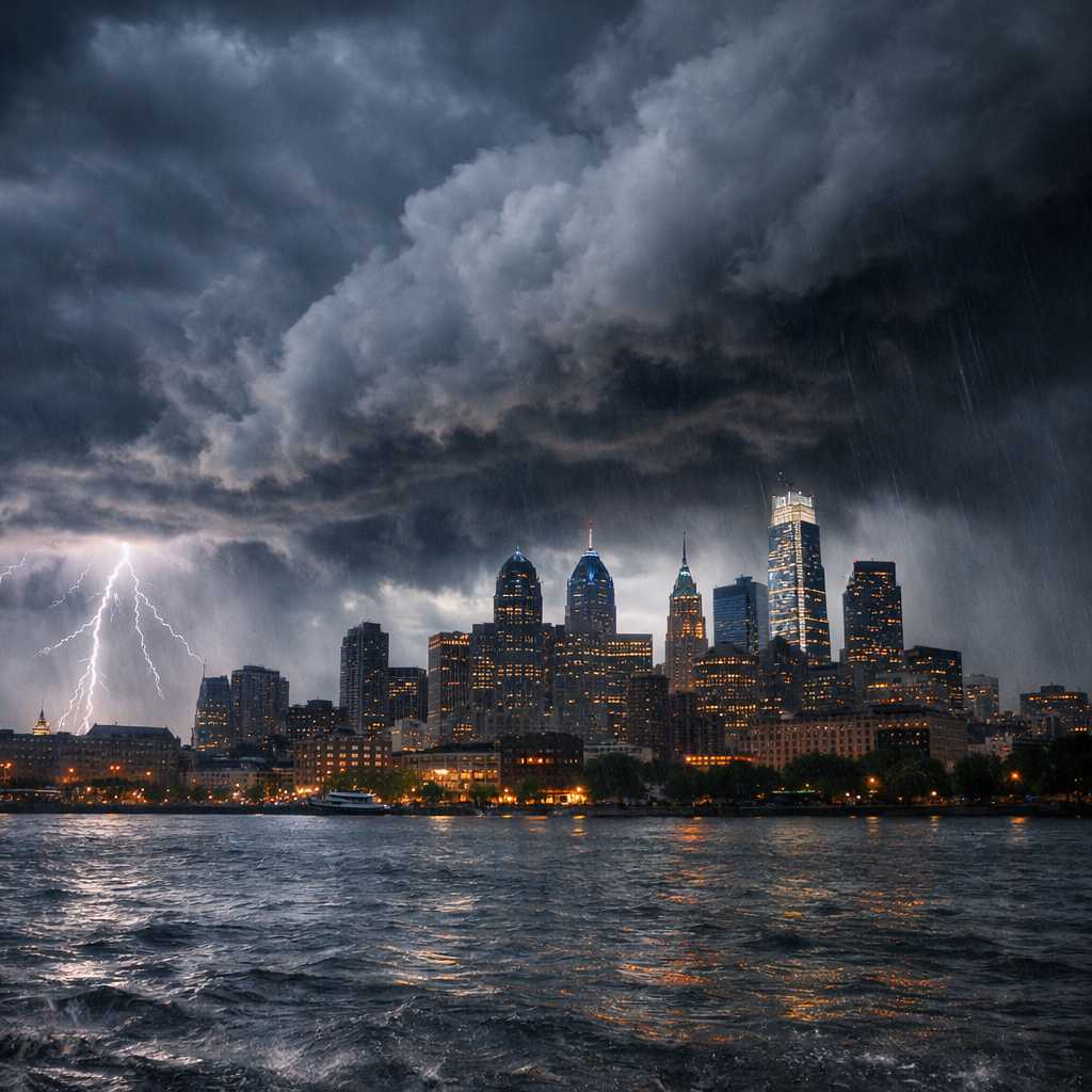
Philadelphia is heading into a dramatic weather shift as unseasonably warm temperatures collide with a powerful storm system moving across the United States. Forecasters say the region could see severe thunderstorms Wednesday afternoon and evening, bringing damaging winds up to 70 mph, heavy rain, and even a brief isolated tornado. The sudden change comes after temperatures surged into the 80s earlier in the week, creating ideal conditions for volatile spring-like storms.
The combination of record-challenging warmth and an approaching cold front is creating the perfect environment for severe weather development. Residents across Philadelphia and nearby areas are being urged to stay alert as storms could rapidly intensify during the late afternoon and evening hours.
Temperatures Could Challenge a Record High
Philadelphia is expected to experience unusually warm conditions before storms arrive. Meteorologists say temperatures may climb into the mid-70s on Wednesday, potentially challenging the record high of 74°F set in 2021. Overnight temperatures will also remain mild, with lows staying in the 50s before the weather pattern dramatically shifts.
This warm air mass is one of the key ingredients fueling the severe storm risk. When warm, moist air collides with an incoming cold front, the atmosphere becomes unstable, increasing the chances for thunderstorms capable of producing strong winds and dangerous weather conditions.
Severe Storm Threat Between 3 PM and 11 PM
According to meteorologists, the main window for severe storms in the Philadelphia region will likely occur between 3:00 p.m. and 11:00 p.m. During this time, thunderstorms could rapidly strengthen and produce damaging wind gusts reaching 60 to 70 miles per hour.
Strong winds remain the biggest concern. Gusts at those speeds are capable of knocking down tree limbs, damaging roofs, and causing scattered power outages across neighborhoods. Loose outdoor objects such as patio furniture or trash bins could also become dangerous projectiles if storms intensify.
While wind is the primary threat, meteorologists say the possibility of a brief isolated tornado cannot be completely ruled out. Storm rotation could develop if the atmosphere becomes unstable enough during the afternoon.
Additional risks include localized flash flooding, particularly in areas with poor drainage or locations that receive repeated heavy downpours from slow-moving thunderstorms.
Storm Strength Depends on Sunshine
One important factor that could influence the intensity of Wednesday’s storms is sunshine earlier in the day. If cloud cover breaks and the region receives several hours of sunlight, temperatures may rise even further, adding extra energy to the atmosphere.
More sunshine means warmer air near the surface, which can increase atmospheric instability and allow storms to strengthen quickly. On the other hand, persistent cloud cover could slightly limit storm intensity by preventing temperatures from rising as much.
This uncertainty is why forecasters are closely monitoring satellite and radar conditions throughout the day to determine how severe the storms might become.
Powerful Cold Front Brings Major Temperature Drop
Once the storms move through the region, the weather pattern will shift dramatically. A strong cold front sweeping across the eastern United States will bring a rapid drop in temperatures across Pennsylvania and surrounding states.
Meteorologists say temperatures could fall into the 30s and 40s shortly after the storms pass. By Friday morning, some suburban areas around Philadelphia could even see temperatures dip into the 20s.
The cooler air will remain in place through the weekend, with daytime highs only reaching the 50s. Forecast models also suggest that next week could bring even colder conditions, with some days struggling to reach the upper 30s.
In an unusual twist for mid-March, some computer weather models are even hinting that a few wet snowflakes could mix in as the cold front exits the region.
Storm System Already Producing Tornadoes in the Midwest
The same powerful weather system responsible for the severe storm threat in Philadelphia has already caused significant weather across the Midwest. Confirmed tornadoes were reported near Chicago and Kankakee, Illinois, highlighting the strength of the storm system moving eastward.
As the system continues to travel across the country, it is expected to bring a similar risk of severe weather to parts of the Mid-Atlantic and Northeast.
Residents can monitor severe weather updates and forecasts through the NOAA Storm Prediction Center, which provides real-time outlooks and storm risk assessments across the United States.
Tornado Warnings Issued in Western Pennsylvania
Earlier Wednesday, tornado warnings were issued in parts of western Pennsylvania, including Allegheny, Washington, and Greene counties near Pittsburgh. Weather radar detected rotation within a severe thunderstorm moving east at roughly 40 miles per hour.
The storm passed near communities such as Mount Lebanon, Bethel Park, McKeesport, and West Mifflin. Officials warned that flying debris could pose a serious risk to anyone caught outdoors.
While those specific tornado warnings were later canceled, a tornado watch remained in effect for several counties until the evening as the broader storm system continued moving across the region.
Safety Precautions for Residents
With severe weather possible, officials are advising residents to stay alert for warnings during the afternoon and evening hours. If a tornado warning is issued, people should move immediately to an interior room on the lowest floor of a sturdy building and stay away from windows.
Those who are outdoors, in vehicles, or in mobile homes should seek the nearest substantial shelter as quickly as possible. Flying debris during severe storms can cause serious injuries even when tornadoes are brief.
Preparedness tips and emergency guidance are available through Ready.gov, which outlines steps families can take to stay safe during severe weather events.
What Happens Next
After the storms pass and temperatures fall sharply, the region will enter a colder pattern heading into the weekend and early next week. Additional showers may return by Monday, followed by some of the coldest air of the season so far.
For Philadelphia residents, the next 24 hours will bring a striking weather contrast — from record-challenging warmth to potentially dangerous storms and then a rapid plunge back into winterlike temperatures.
Make Swikblog your go-to source on Google for reliable updates, smart insights, and daily trends.