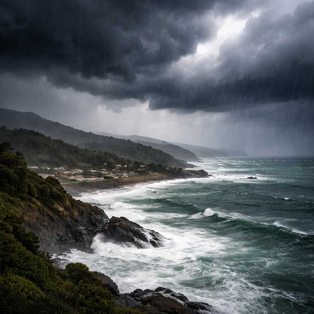
New Zealand is bracing for a powerful multi-hazard weather system, with Northland placed under a rare red heavy rain warning as a subtropical low approaches. Authorities say the next 48 hours could bring up to 320mm of rain, severe winds, thunderstorms, and dangerous coastal conditions, prompting urgent warnings from Civil Defence and MetService.
The storm is already being described as an “impactful multi-hazard event”, with the potential to cause flooding, slips, travel disruption, and widespread hazards across multiple regions. Officials are urging residents to act early as conditions are expected to rapidly worsen from Wednesday afternoon.
Red warning issued for Northland with up to 320mm rain forecast
The most severe conditions are expected in Northland, particularly east of Kaikohe, covering areas from Doubtless Bay to Whangārei. This region is under a red heavy rain warning from 4pm Wednesday until 4am Friday.
MetService forecasts between 270mm and 320mm of rain, with peak intensity expected from Thursday afternoon through to early Friday morning. Thunderstorms are also possible during this period, increasing the risk of sudden downpours and flash flooding.
Red warnings are reserved for the most extreme weather events, meaning significant impacts and disruption are highly likely. Residents are being urged to take immediate precautions to protect people, animals, and property.
Orange warning could escalate as rest of Northland remains at risk
The remainder of Northland is currently under an orange heavy rain warning for the same period, from Wednesday afternoon to early Friday. However, forecasters have warned there is a high likelihood this could be upgraded to a red warning if conditions intensify.
This escalation risk highlights the severity and uncertainty of the developing storm, as rainfall bands shift and intensify across the region.
Civil Defence mobilises as emergency preparations begin
Northland Civil Defence has confirmed it is actively coordinating with local councils, emergency services, and hydrology teams. Resources are being positioned across the region to respond quickly if flooding or damage occurs.
Officials are urging residents to prepare now by clearing drains, securing outdoor items, checking emergency kits, and staying informed through official updates.
Communities are also being encouraged to check on neighbours, especially those who may be vulnerable, and to plan ahead for potential disruptions.
Dangerous driving conditions expected across flood-prone areas
Transport authorities have warned that roads could become hazardous, particularly in flood-prone locations such as Whakapara, Kaeo, and Rangiahua. Drivers are being advised to delay non-essential travel and exercise extreme caution.
NZTA has stressed that motorists should never attempt to drive through floodwaters and must follow all road signs and emergency instructions.
The incoming weather system has been compared to the severe January weather event, raising further concern about potential impacts on infrastructure and travel.
Strong winds, thunderstorms and large waves add to the threat
In addition to heavy rainfall, strong wind warnings are in force for Northland from Wednesday night, and for Auckland and Great Barrier Island from Thursday morning.
These winds could lead to fallen trees, power outages, and dangerous driving conditions, especially in exposed areas.
Large coastal swells are also expected, with waves exceeding 4 metres along the northeast coast of the North Island, including Northland. In the South Island, western coastal regions could see swells exceeding 6 metres by Friday.
Mariners and coastal communities are being warned to prepare for hazardous sea conditions, with strong northerly swell building from Wednesday.
Multiple regions across New Zealand under warnings and watches
The storm is not limited to Northland. Heavy rain warnings are also in place for Great Barrier Island, Auckland north of Whangaparāoa, and the Coromandel Peninsula.
Additional heavy rain warnings extend to Bay of Plenty west of Whakatāne, Tasman west of Motueka, Richmond and Bryant Ranges.
Meanwhile, heavy rain watches cover a wide range of regions including Auckland south of Whangaparāoa, Taranaki Maunga, inland Marlborough ranges, Westland District ranges, North Otago, and Canterbury south of Timaru.
Strong wind watches are also in effect for areas such as Banks Peninsula, Waikato, Taupō, Taumarunui, Taihape, Whanganui, South Taranaki, and Coromandel Peninsula.
This widespread coverage highlights the national scale of the weather system and its potential to impact multiple regions simultaneously.
Events and outdoor activities face disruption
The severe weather is already impacting public events. In Waikato, the Balloons Over Waikato festival faces possible disruptions due to wind conditions.
Flight decisions will depend on wind speed and direction at multiple altitudes, with safety being the top priority. Organisers have indicated that flights may be cancelled or replaced with alternative activities depending on conditions.
This reflects how the storm could affect not just safety, but also daily life, travel, and community events across affected areas.
Why this is a high-impact multi-hazard event
MetService has described the approaching system as a multi-hazard event because it combines several dangerous elements over multiple days.
These include intense rainfall, strong winds, thunderstorms, and large coastal waves, all occurring within a short timeframe.
Such conditions significantly increase the risk of flooding, slips, infrastructure damage, and disruption to essential services.
For the latest updates and official warnings, visit the MetService severe weather warnings page or follow guidance from Civil Defence New Zealand.
Authorities urge immediate preparation as storm approaches
Officials stress that a red warning means “act now”. Residents in high-risk areas should not wait until conditions worsen.
Preparation steps include securing property, avoiding travel during peak weather, staying updated through official channels, and being ready to follow emergency instructions if required.
With Northland expected to take the brunt of the storm and other regions also under threat, the next 48 hours will be critical for communities across New Zealand.
This is not just another weather system — it is a serious, high-impact event that demands attention, preparation, and caution.
Make Swikblog your go-to source on Google for reliable updates, smart insights, and daily trends.