Ottawa is staring at a messy and potentially hazardous end to March, with a mix of steady rain, freezing drizzle and uncertain temperatures setting the stage for a difficult day across the capital. A special weather statement has been issued as Environment Canada warns that conditions could shift quickly, raising concerns about slippery roads and a disrupted morning commute.
The headline figure is significant: between 20 and 30 millimetres of rain is expected to fall through the day. On its own, that amount would already make for a wet and uncomfortable stretch. But the real concern lies in the temperature hovering near the freezing mark, creating the risk that some of that precipitation could fall as freezing rain or freezing drizzle instead.
Forecasters say two separate waves of precipitation are expected to move through Ottawa, and it is during these periods that the risk becomes harder to predict. “There remains great uncertainty,” Environment Canada noted, especially when it comes to whether temperatures will stay below zero. If they do, freezing rain could develop. If temperatures rise just slightly, the city may see plain rain instead. That narrow margin is what makes this system particularly tricky.
The timeline of the day adds another layer of concern. There is a risk of freezing drizzle between 6 a.m. and 3 p.m., directly overlapping with peak commuting hours. Periods of rain are expected through the morning, ending near noon, before giving way to cloudy skies and a 60 per cent chance of drizzle in the afternoon. Rain is then forecast to return around 4 p.m., potentially impacting the evening commute as well.
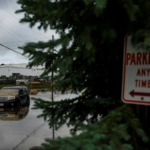
Even if freezing rain does not fully materialize across the city, patches of freezing drizzle can still create hazardous conditions. Roads, sidewalks and parking lots may become icy in spots, particularly on untreated surfaces and elevated areas like bridges. For drivers and pedestrians alike, this kind of weather often proves more dangerous than heavier storms because it can be harder to detect.
Despite the risk, school transportation is operating. The Ottawa Student Transportation Authority confirmed that buses and vans are running for English Catholic and Public Schools as well as French Catholic and Public Schools within the city. However, officials have cautioned that delays are possible, and parents are being advised to plan accordingly as conditions evolve through the morning.
The temperature is expected to reach a high of around 2 C, before settling near 0 C overnight. That steady, near-freezing range is key to the uncertainty. A slight drop could turn wet roads icy within hours, while a slight rise could keep conditions mainly rainy. Environment Canada has also warned of a continued risk of freezing rain into the evening and overnight period, meaning the impact may extend beyond just the daytime hours.
Looking ahead, the unsettled weather pattern is not expected to clear immediately. Wednesday is forecast to be mainly cloudy with a high of 8 C, offering a brief break. But Thursday could bring another round of freezing rain or rain, with temperatures again hovering near 2 C. Friday is expected to stay cloudy with a 60 per cent chance of showers and a high near 0 C, while Saturday may see a more seasonal rebound with cloudy skies and a high of 8 C.
For this time of year, Ottawa typically sees daytime highs around 7 C and nighttime lows near -2 C. While this week’s temperatures are not far off normal, the combination of moisture and borderline freezing conditions makes today’s system particularly impactful.
The situation is not limited to Ottawa. In Greater Sudbury and surrounding areas, a freezing rain warning remains in effect, with hazardous conditions expected to begin overnight and continue through Tuesday evening. Similar to Ottawa, the system is expected to arrive in two waves, with a temporary break during the day before another round moves in later.
Officials in Sudbury are warning that untreated roads and walkways could quickly become icy and dangerous. Drivers are being urged to slow down, allow extra travel time and stay alert, especially during morning and evening hours when temperatures are most likely to remain below freezing. The uncertainty around precipitation type — whether it falls as freezing rain, drizzle or even transitions to regular rain — means conditions could vary significantly across short distances.
Back in Ottawa, the message is clear: expect changing conditions and plan ahead. What starts as light rain could shift into freezing drizzle without much warning, particularly in the early hours of the day. Commuters, pedestrians and anyone heading outdoors should remain cautious and keep an eye on updated forecasts.
For the latest official alerts and forecast updates, residents can visit Environment Canada’s website. As Ottawa moves through this uncertain weather pattern, a little extra caution could make a big difference in avoiding delays, slips or more serious incidents.
You may like: US gold price today surges to $4,587 per ounce as COMEX gold climbs 0.66%
Make Swikblog your go-to source on Google for reliable updates, smart insights, and daily trends.