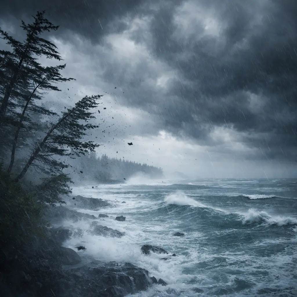
A powerful Pacific storm is sweeping across Western Canada, bringing destructive winds, heavy rain, and dangerous snowfall conditions to British Columbia and Alberta. The system has already knocked out power for more than 53,000 customers at its peak, with thousands still in the dark as strong winds continue to batter parts of the province.
With wind gusts reaching up to 100 km/h, officials have issued widespread warnings across coastal and interior regions of B.C., urging residents to avoid unnecessary travel and prepare for rapidly changing conditions.
100 km/h winds trigger mass power outages in B.C.
The biggest immediate impact has been widespread power outages caused by strong winds knocking down trees and power lines. Vancouver Island was hit particularly hard, where more than 53,000 BC Hydro customers lost electricity at the height of the storm.
Although the number of outages dropped to under 40,000 later in the evening, thousands of homes and businesses remain affected. Wind gusts across the region reached between 80 and 100 km/h, strong enough to cause structural damage, falling debris, and dangerous road conditions.
Environment Canada confirmed that while some coastal wind warnings were lifted, strong winds are still expected across the southern and central Interior, including areas like the South Thompson, Nicola, 100 Mile, Chilcotin, and along the Coquihalla Highway.
Heavy rain hits Lower Mainland while mountains see 50 cm snow
This storm is delivering a mix of extreme weather depending on elevation. The Lower Mainland is forecast to receive between 30 and 40 mm of rain, increasing the risk of water pooling on roads, reduced visibility, and localized flooding in low-lying areas.
Meanwhile, higher elevations are experiencing intense snowfall. Alpine regions could receive up to 50 cm of snow, providing a boost to ski resorts like Whistler Blackcomb but creating hazardous travel conditions in mountain passes.
Snowfall totals of 15 to 30 cm are expected in key B.C. routes such as Kootenay Pass, Rogers Pass, and Kicking Horse Pass by Tuesday night. These conditions, combined with strong winds, could lead to whiteout conditions and dangerous driving situations.
Alberta and Rockies face snow, avalanche risks and closures
The storm is not limited to British Columbia. As it moves east, Alberta is also seeing significant impacts, especially in the Rockies. Forecasters say an additional 20 to 30 cm of snow could fall in these regions, increasing avalanche danger.
The Icefields Parkway has already been closed due to avalanche concerns, highlighting the severity of the situation in mountainous areas. Travel through these regions is strongly discouraged unless absolutely necessary.
Farther east, a developing weather system is expected to bring snow into central Alberta, particularly along the Yellowhead Highway. Areas from Edmonton to west-central Saskatchewan could see up to 10 cm of snowfall by Wednesday, along with reduced visibility due to blowing snow.
Winter storm and wind warnings issued across the region
Environment Canada has issued multiple warnings and alerts across British Columbia. Winter storm warnings are in place for north-central regions, including Prince George and the Peace region, where up to 25 cm of snow and near-zero visibility are expected.
Special weather statements are also active in areas such as the eastern Fraser Valley and key mountain highways like Highway 3 and the Okanagan Connector. Winds in these regions could still gust up to 80 km/h before gradually easing.
Officials are warning that conditions can deteriorate quickly, making travel unpredictable and potentially dangerous. Drivers may encounter sudden visibility loss, slippery roads, and unexpected closures.
Travel disruptions and safety risks increase
The combination of strong winds, heavy rain, and blowing snow is creating widespread travel disruptions. High-profile vehicles are especially vulnerable to strong crosswinds, while mountain routes face whiteout conditions and avalanche threats.
Authorities are advising residents to postpone non-essential travel and stay updated on local conditions. Service disruptions, including transportation delays and power outages, are expected to continue as the storm progresses.
Residents are also warned to stay away from fallen power lines and report hazards immediately. Even after winds begin to ease, cleanup and restoration efforts could take time.
What residents should do right now
With conditions changing rapidly, preparation is key. Residents should secure outdoor items, charge mobile devices, and keep emergency supplies such as flashlights, batteries, and food ready in case of prolonged outages.
If travel is necessary, drivers should carry winter gear, including blankets, water, and emergency kits. Mountain travel should be avoided unless absolutely required due to the high risk of snow accumulation and avalanches.
For the latest updates and official warnings, visit Environment Canada and track outage information through BC Hydro.
Storm outlook: hazardous conditions continue midweek
This powerful storm system is expected to continue moving east across Canada through midweek, extending its impact beyond B.C. and Alberta. While some regions may see gradual improvement, others could continue facing snow, wind, and travel disruptions.
The combination of 100 km/h winds, heavy rainfall, up to 50 cm snowfall, and widespread power outages makes this one of the most significant weather events currently affecting Western Canada.
Residents across the region are urged to stay alert, monitor forecasts closely, and prioritize safety as the storm continues to unfold.
Make Swikblog your go-to source on Google for reliable updates, smart insights, and daily trends.