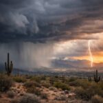
Alabama is facing a dangerous wildfire setup this weekend as weather officials warn that a combination of strong winds, extremely low humidity, and dry ground conditions could trigger fast-spreading fires across large parts of the state. A Red Flag Warning and Fire Weather Watch have been issued, signaling that conditions on Saturday could quickly turn hazardous.
The alert mainly targets North and Central Alabama, where the highest fire risk is expected between 7 a.m. and 7 p.m. on Saturday. During this time, even a small spark could escalate into a rapidly spreading wildfire due to the volatile weather pattern moving into the region.
Authorities are urging residents to take this warning seriously, avoid outdoor burning, and follow all local restrictions as conditions could worsen quickly throughout the day.
Dry cold front creating dangerous fire conditions
The primary driver behind this elevated wildfire threat is a dry cold front moving through Alabama starting Friday night. Behind this front, forecasters expect a sharp drop in humidity along with a noticeable increase in wind speeds.
This shift in weather is critical. As the dry air settles in, it pulls moisture out of vegetation such as grass, leaves, and wood. At the same time, stronger winds help fires spread faster and carry embers over longer distances, increasing the chance of new fires starting.
This combination of dry air and gusty wind is often referred to as a “perfect recipe” for wildfire development — and that’s exactly what Alabama is facing heading into Saturday.
Red Flag Warning vs Fire Weather Watch explained
The National Weather Service initially issued a Fire Weather Watch, which is an early warning that conditions are favorable for wildfires. However, as confidence in the forecast increased, parts of Alabama were upgraded to a Red Flag Warning.
A Red Flag Warning means that critical fire weather conditions are either occurring or expected within 24 hours. This is the highest level of fire weather alert and should be treated as a serious public safety warning.
Officials emphasized that “any fires that develop will likely spread rapidly”, highlighting the urgency of the situation.
Key numbers behind Alabama’s wildfire risk
The concern is driven by several critical forecast values that significantly increase fire danger:
Wind gusts: Expected between 30 to 35 mph, especially during midday
Relative humidity: Dropping as low as 19% to 23%
Timing: Highest risk from 7 a.m. to 7 p.m. Saturday
Wind direction: North to northeast winds adding to fire spread potential
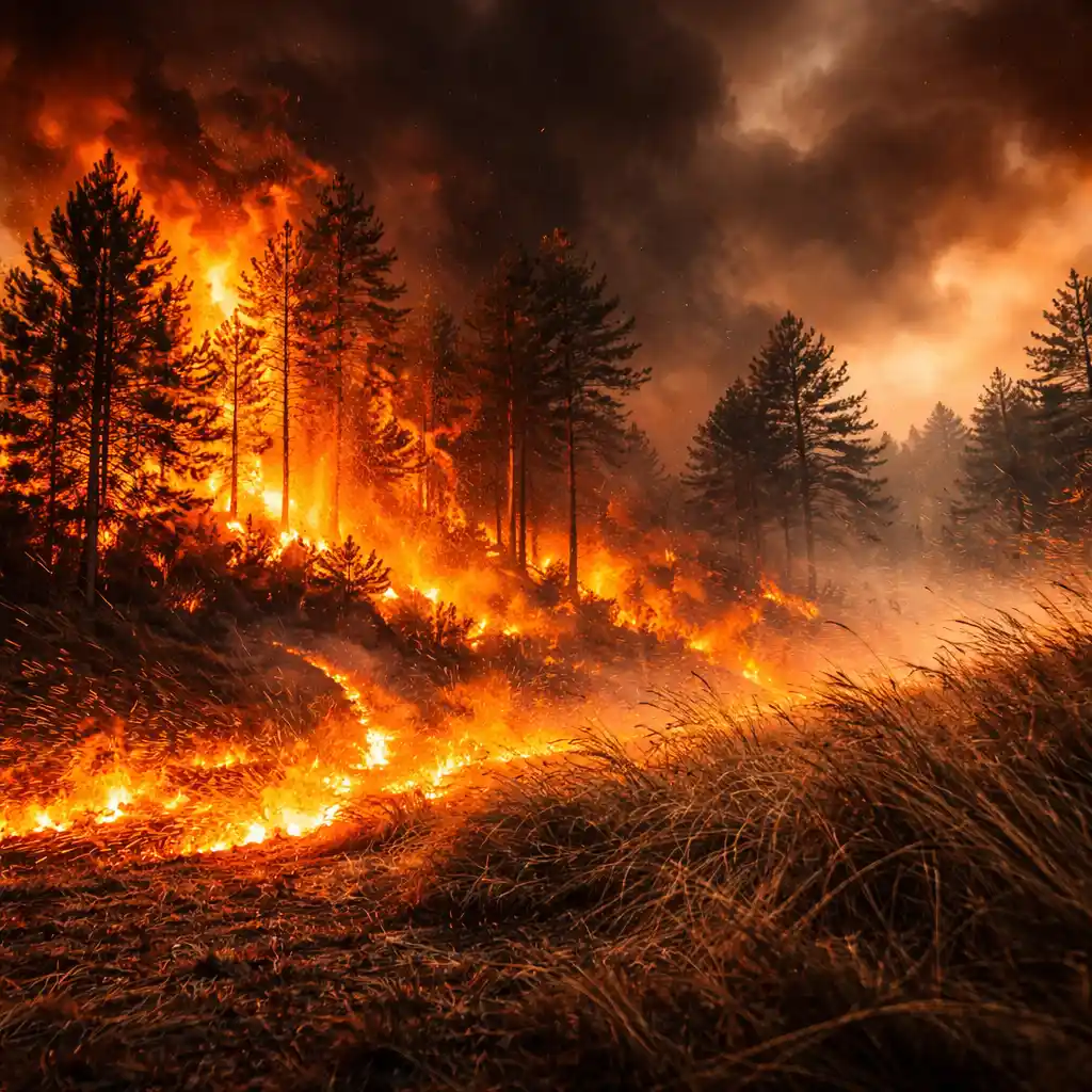
When humidity falls below 25%, vegetation becomes extremely dry and more flammable. Combined with strong winds, fires can spread quickly across fields, wooded areas, and even toward residential zones.
Drought conditions making situation worse
Another major factor increasing the fire risk is the ongoing dryness across many parts of Alabama. Several areas are already experiencing dry or drought-like conditions, meaning vegetation is stressed and lacks moisture.
This creates ideal fuel for fires. Dry grass, leaves, and brush can ignite quickly, and once a fire starts, it becomes much harder to control. The weather conditions expected on Saturday will only amplify this risk.
Anniston burn ban and local restrictions
Local authorities are already taking action to prevent potential disasters. The Anniston Fire Department has issued a burn ban from March 26 through March 29.
Under this order:
- All outdoor burning is strictly prohibited
- No burn permits will be issued
- The ban applies within Anniston city limits and nearby areas of Calhoun County
Officials say conditions will be reevaluated after March 29, but until then, residents are expected to fully comply to reduce fire risk across the community.
Why even small sparks can become dangerous
Under normal conditions, small fires may stay contained or burn out quickly. But during a Red Flag Warning, the situation is very different.
With strong winds and dry air:
- Fires spread faster across open land
- Embers can travel and ignite new fires nearby
- Control efforts become more difficult for fire crews
This means that everyday actions — like tossing a cigarette, lighting a grill near dry grass, or parking a car on dry vegetation — can unintentionally start a wildfire.
Safety precautions residents should follow
Officials are strongly advising residents to take precautionary steps throughout Saturday:
- Avoid all outdoor burning, including trash and yard debris
- Do not use fire pits or campfires
- Keep grills away from dry grass and vegetation
- Avoid parking vehicles on dry grass
- Properly dispose of cigarettes
- Be cautious with any equipment that may create sparks
These steps may seem simple, but they play a crucial role in preventing fires during high-risk weather conditions.
Statewide wildfire threat continues to grow
The wildfire threat is not limited to one city or county. Weather experts have warned that large portions of Alabama could face elevated fire danger due to the widespread nature of the dry air and wind pattern.
As conditions peak during the day, the risk of fast-spreading fires remains high, especially in rural areas, wooded regions, and places with dry vegetation.
Residents are encouraged to monitor updates from the National Weather Service and follow any new alerts issued throughout the weekend.
Outlook: Will conditions improve after Saturday
There is some expectation that winds may ease slightly later in the day, but the overall fire risk will remain elevated during peak hours. Until humidity levels recover and conditions become less dry, the threat will not fully disappear.
For now, Saturday remains the most critical period, and officials are emphasizing prevention as the best defense against wildfire outbreaks.
The bottom line is clear: Alabama is entering a high-risk fire weather event. With wind gusts reaching up to 35 mph and humidity dropping near 20%, the conditions are highly favorable for rapid fire spread. Residents should avoid any activities that could start a fire and remain alert as the situation develops.
Make Swikblog your go-to source on Google for reliable updates, smart insights, and daily trends.