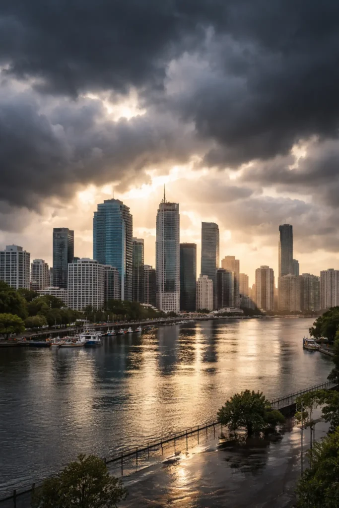
Brisbane started the week under a calm, bright sky: partly sunny, about 21°C around early morning, with light winds and only a small chance of rain. It’s the kind of gentle weather that makes last week’s anxiety feel distant. Yet across south-east Queensland, many households and councils were still coming down from a very different mood — the tense, practical kind that follows a headline forecast promising a possible 300mm soaking and the flood planning that comes with it.
In simple terms, Brisbane saw a much quieter outcome than the biggest numbers suggested. That gap between the feared deluge and what actually landed has now become the story: not only what the weather did, but how the warning was understood, why it shifted, and what it means for the next time Queensland is told to brace.
What Brisbane is seeing now: The immediate pattern looks like a warm run with daytime highs lifting through the week — mid-to-high 20s early, then pushing hotter midweek — before a slightly wetter note returns closer to the weekend. It’s a familiar Brisbane rhythm: heat builds, humidity lingers, and any real rain threat tends to arrive in bursts rather than a steady all-day drench.
Why the 300mm figure became so prominent: Extreme rainfall numbers cut through in a way most weather language does not. They’re easy to repeat, easy to fear, and hard to “mentally average.” Even when a forecast is framed as a possibility for particular locations, the number can travel faster than the nuance. For communities that still carry memories of sudden flooding, a big total isn’t just information — it’s a trigger for action.
The news angle: Australia’s Bureau of Meteorology has defended the forecast after the heaviest falls did not hit Brisbane as projected. The bureau’s explanation centres on how coastal systems behave when they wobble, stall, or shift just enough to move the rainfall core. In these setups, a small change in the track or timing can mean one suburb gets a soaking while another, only a short drive away, watches the clouds slide past.
What likely changed on the ground: The atmosphere can be primed for heavy rain — warm sea surface temperatures, deep moisture, a triggering trough — and still fail to deliver the biggest totals over the biggest population centre. The most intense rain can concentrate into narrow corridors. When that corridor drifts, totals can collapse quickly for the places that were expecting the worst. That doesn’t always mean the forecast was made in bad faith; it can mean the “high-end” outcome simply didn’t verify in the exact area most people were watching.
Why this matters beyond one weekend: Forecast credibility is a fragile thing. A warning that feels overstated can breed complacency the next time, even when the next threat is real. At the same time, under-warning is the scenario that causes genuine harm. The bureau’s job is to flag risk early enough for people to prepare, but early warnings come with uncertainty — and uncertainty is harder to communicate than a single dramatic number.
The preparedness ripple effect: When major rainfall totals are on the table, councils and emergency services tend to plan for the upper end because the cost of being unready is so high. Sandbag stations, staffing plans, and community messaging all move faster once a high-impact scenario enters the frame. If the rain then shifts away, the public can be left wondering whether the response was disproportionate. But preparedness isn’t wasted simply because the worst case doesn’t arrive; it’s the insurance premium a city pays to avoid chaos when it does.
What to watch next in Brisbane wether: The bigger signal is that Queensland remains in a season where conditions can pivot quickly. If temperatures climb toward the low 30s midweek and humidity holds, the atmosphere stays ready for sharp afternoon bursts later on. The practical takeaway isn’t panic — it’s attentiveness to how alerts are updated in real time, and whether the heaviest band is trending toward the city or away from it.
For readers who want the most direct official guidance on warnings, radar and rainfall updates, the bureau’s Queensland pages remain the essential reference point via the Bureau of Meteorology.
For ongoing Brisbane updates and local reads, you can also follow the latest coverage on Swikblog.
For now, Brisbane looks set for a warmer stretch with only limited rain risk in the immediate picture — but the conversation sparked by the “300mm” forecast will linger longer than the clouds did. In a city that lives with summer volatility, the challenge is balancing early caution with clear, evolving detail, so the next genuine threat lands with trust intact.
Make Swikblog your go-to source on Google for reliable updates, smart insights, and daily trends.