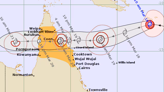
Cyclone Narelle has formed in the Coral Sea and is rapidly intensifying, with forecasts indicating it could reach Category 5 strength before making landfall along the Far North Queensland coast later this week. If that happens, it would place Narelle among the most dangerous tropical cyclones on record in the region, raising serious concerns for coastal communities already on alert.
This is now the third severe weather system to threaten Queensland in less than two months, adding to growing concerns about repeated extreme weather events across the state. Authorities are urging residents not to focus only on the category label, but to understand the real risks that come with a storm of this magnitude.
What makes a Category 5 cyclone so dangerous
Tropical cyclones in Australia are ranked from Category 1 to Category 5 based on their maximum sustained wind speeds. A Category 5 cyclone represents the highest level on this scale and is officially classified as “extremely dangerous.”
According to the Bureau of Meteorology, a Category 5 system has:
- Maximum sustained winds exceeding 200 km/h
- Typical wind gusts greater than 279 km/h
- Potential for widespread destruction of buildings and vegetation
These conditions are strong enough to tear roofs from homes, flatten trees, destroy infrastructure, and leave communities without power or communication for extended periods. Even well-built structures can suffer major damage under such extreme wind forces.
There is still uncertainty about whether Cyclone Narelle will maintain Category 5 intensity at landfall, as systems often weaken slightly before crossing the coast. However, even a downgrade to Category 4 would still pose a severe threat.
The three major threats: wind, rain, and storm surge
Regardless of category, tropical cyclones bring three primary hazards — all of which can cause serious damage and risk to life.
1. Destructive winds: Gale-force winds can turn everyday objects into dangerous airborne debris. Trees, roofing materials, and unsecured items can become projectiles. When the eye of the cyclone passes, there may be a temporary calm, but this is quickly followed by destructive winds returning from the opposite direction.
2. Heavy rainfall and flooding: Cyclones can deliver intense rainfall that continues even after the system moves inland. Flooding can affect roads, homes, and farmland, sometimes isolating communities for days.
3. Storm surge: This is often the most dangerous threat. Strong winds combined with low pressure can push seawater above normal tide levels, flooding coastal areas and driving water inland for several kilometres. These surges can be unpredictable and extremely destructive.
Experts warn that storm surges have historically been one of the deadliest aspects of tropical cyclones, particularly in low-lying coastal regions.
How Cyclone Narelle compares to past major storms
Category 5 cyclones are relatively rare in Australia, but when they do occur, the impact can be severe.
The most recent example was Tropical Cyclone Ilsa, which made landfall on Western Australia’s north coast on April 13, 2023. The system recorded wind gusts of up to 289 km/h and even damaged Bureau of Meteorology equipment. It also set an Australian record with a 10-minute sustained wind speed of 218 km/h.
Ilsa weakened to Category 3 within hours after landfall, highlighting how quickly cyclone intensity can change once it moves over land.
In Queensland, the last Category 5 cyclone to make landfall was Cyclone Marcia in 2015. That storm caused widespread destruction around Yeppoon and Rockhampton, damaging nearly 2,000 properties and triggering around 40,000 insurance claims. The agricultural sector alone suffered an estimated $200 million in losses.
These past events offer a clear picture of what a Category 5 system like Narelle could potentially bring if it maintains its strength.
Why the path and timing matter
One of the biggest challenges with cyclones is their unpredictability. Small changes in track or speed can significantly alter which areas are impacted most. The timing of landfall is also critical, particularly when it comes to storm surge risk, as impacts can be amplified if the cyclone arrives during high tide.
Forecasters are currently monitoring whether Narelle may cross the coast north of Cooktown, but residents across a wider region are being advised to stay alert.
How to prepare before conditions worsen
Emergency authorities are urging residents to act early rather than wait for conditions to deteriorate. Preparation steps include:
- Securing loose outdoor items such as furniture and tools
- Checking roofs, gutters, and drainage systems
- Preparing an emergency kit with food, water, and essentials
- Charging mobile devices and backup batteries
- Filling fuel tanks in vehicles
- Knowing how to turn off electricity, gas, and water
- Making arrangements for pets
- Using sandbags in flood-prone areas
Residents should also prepare for power outages and possible disruptions to communication networks.
Where to get real-time updates
Staying informed is critical as Cyclone Narelle approaches the coast. The ABC Emergency website provides live updates, warning maps, and official advice.
Emergency broadcasts are also available via ABC Radio across Far North Queensland, including:
- Cairns: 801 AM and 106.7 FM
- Cooktown: 105.7 FM
- Mossman and Port Douglas: 639 AM
- Weipa: 1044 AM
Residents can also access updates through the ABC Listen app or via satellite services.
A critical few days ahead
Cyclone Narelle’s development over the coming days will determine just how severe the impact will be, but the early signs point to a potentially powerful system. Whether it makes landfall as a Category 5 or weakens slightly beforehand, the risks remain significant.
For Queensland communities in its path, this is not a situation to take lightly. Understanding the threats, preparing early, and staying updated with official warnings could make a crucial difference as the cyclone approaches.
You may also like: BHP Stock Rises as Resolution Copper Project Gains Key US Approval
Make Swikblog your go-to source on Google for reliable updates, smart insights, and daily trends.