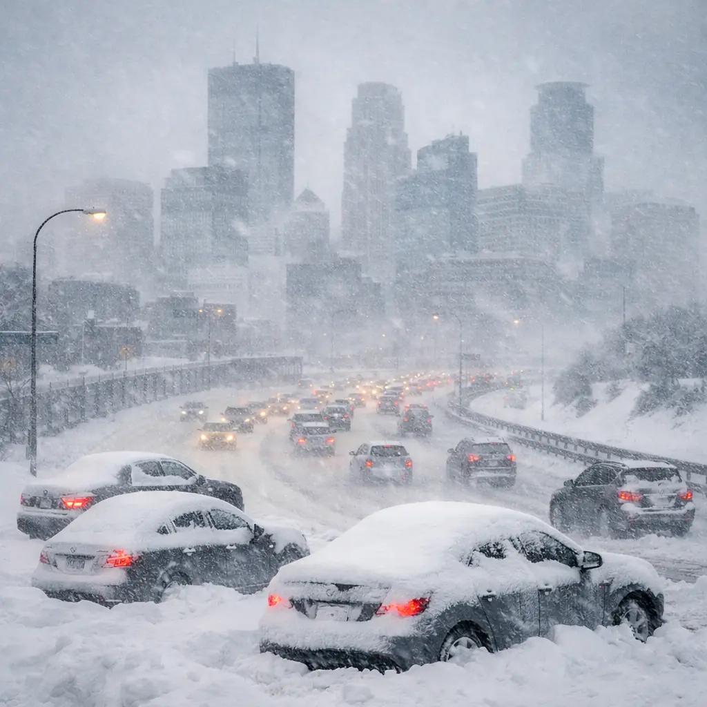
Minnesota is experiencing one of the most powerful winter storms of the season as a major March blizzard spreads across the state. Heavy snowfall, strong winds, and whiteout conditions are creating widespread disruptions, particularly across southern Minnesota and the Twin Cities metro area.
Officials have issued serious travel warnings as the storm intensifies Sunday. Meteorologists say many locations could end up with more than a foot of snow by the time the system moves out. In some isolated spots, totals could exceed 18 inches, making this one of the largest snow events of the winter season.
The situation has become serious enough that Minnesota Governor Tim Walz has signed an executive order authorizing the Minnesota National Guard to support emergency operations if needed.
Travel Not Advised Across Southern Minnesota
Authorities are warning drivers to stay off the roads across several parts of southern Minnesota due to dangerous weather conditions. The Minnesota Department of Transportation reported widespread whiteout conditions caused by blowing snow and strong winds.
The advisory includes areas such as New Prague, Northfield, Granite Falls, and Gaylord, as well as portions of Interstate 35 and Interstate 90. Transportation officials say blowing snow and gusty winds are making travel extremely difficult and in some areas nearly impossible.
Road conditions are also deteriorating across the Twin Cities region. Officials say most major roads and highways around Minneapolis and Saint Paul are completely covered in snow, making driving hazardous even for experienced winter drivers.
Twin Cities Braces for Another 6 to 10 Inches of Snow
The Twin Cities metro area has already seen significant snowfall, but forecasters say the storm still has more to deliver. Weather models suggest Minneapolis and Saint Paul could receive another 6 to 10 inches of snow before the storm finally begins to weaken.
By early Sunday morning, Minneapolis–St. Paul International Airport had already recorded about 7.3 inches of snow. Nearby observations from the National Weather Service office in Chanhassen measured roughly 7.6 inches.
Several communities south of the metro have already experienced even heavier snowfall totals. Locations including Savage and Elko New Market reported more than 10 inches of snow early Sunday, with additional accumulation expected as the storm continues.
Forecasters say snowfall rates could reach 1 to 2 inches per hour in some bands, which can quickly overwhelm road crews and make travel extremely difficult.
Strong Winds Creating Blizzard Conditions
Heavy snowfall is being combined with powerful wind gusts that could reach between 30 and 50 miles per hour. These winds are blowing snow across highways and reducing visibility dramatically.
In some areas, visibility has dropped to less than a mile. For example, visibility in Eden Prairie fell to around three-quarters of a mile during the storm as blowing snow intensified.
When strong winds combine with heavy snowfall, blizzard-like conditions can develop quickly. Drivers may experience sudden whiteouts where the road and surrounding environment become nearly impossible to see.
Flights Cancelled at Minneapolis–St. Paul Airport
The storm is also disrupting air travel across the region. A significant number of flights have been cancelled at Minneapolis–St. Paul International Airport as the storm intensifies.
Airlines are advising passengers to rebook their travel plans and check flight status updates before heading to the airport. Snow-covered runways, poor visibility, and strong winds can significantly affect flight operations during major winter storms.
Travel disruptions in Minnesota can also affect airline schedules nationwide, especially when major airports experience weather-related delays.
21 Crashes and Dozens of Vehicles Off the Road
Dangerous road conditions are already leading to numerous accidents across Minnesota highways. According to the Minnesota State Patrol, there were 21 property-damage crashes reported between midnight and 6:30 a.m.
Officials also reported five spinouts and approximately 70 vehicles sliding off the road overnight. In addition, six semi-trucks jackknifed due to slippery and snow-covered roadways.
One crash during the overnight period resulted in an injury, though authorities say additional incidents could occur as the storm continues throughout the day.
Officials warn that snow-covered pavement, drifting snow, and low visibility can make driving extremely risky, especially during heavy snowfall bursts.
Minnesota National Guard on Standby
Due to the severity of the winter storm, Governor Tim Walz authorized the Minnesota National Guard to assist emergency operations across the state.
National Guard units have been placed on standby at armories in Albert Lea, Fairmont, Owatonna, and Redwood Falls. If conditions worsen, these teams could assist with rescue operations, stranded motorists, or emergency support efforts.
State officials say positioning personnel in multiple locations across southern Minnesota allows emergency responders to react quickly if the storm creates dangerous situations for travelers or residents.
Major Storm Could Become Biggest of the Season
Meteorologists say the March storm has the potential to become the largest snowfall event of the winter season in parts of Minnesota. Heavy snowfall combined with powerful winds is creating widespread disruptions across transportation, aviation, and emergency services.
Weather experts warn that the placement of the heaviest snowfall can shift even within 24 hours of the storm, meaning some communities could receive significantly higher totals than initially expected.
Residents are encouraged to monitor official weather updates from the National Weather Service and check road conditions using the Minnesota 511 travel information system.
For now, officials emphasize one important message for residents across Minnesota: avoid unnecessary travel, stay informed about weather alerts, and be prepared for rapidly changing conditions as the storm continues through Sunday and possibly into Monday.
Make Swikblog your go-to source on Google for reliable updates, smart insights, and daily trends.